
- About
-
-
-
Knowledge Mappers is a digital mapping consultancy & publishing company with a unique mix of geographic & knowledge mapping expertise. Our ground-breaking products & services visually connect individuals, teams, organisations & communities with the knowledge resources that they need… to do what they need to do… quicker, easier, and with a lot less stress :-)
Play VideoPlay Video
-
-
-
- Products & Services
-
-
- Geographic Information
- GI Products & Services
- GI Consultancy
- GI Data Sourcing / Capture
- Spatial Analysis
- Map-Enabled Data Portals
- Large Format Printing
- Spatial Data Infrastructure (SDI) Capacity Building
- Geographic Community Mapping
- GI Knowledge Maps
- School Travel Health Check (STHC) Service
- Why Knowledge Mappers For Geographic Mapping?
- GI Client Testimonials & Citations
- Featured Geographic Service
- Geographic Information
-
- Knowledge Mapping
- Knowledge Mapping Products & Services
- Knowledge Mapping Consultancy & Training
- Knowledge Map Download Store
- Bespoke Knowledge Map Creation
- Business Knowledge / Information / Data Mapping
- Meeting Mapping
- Conference / Workshop Mapping
- Community Knowledge Mapping
- Scotland The Map Project
- Why Knowledge Mappers For Knowledge Mapping?
- Knowledge Mapping Client Testimonials
- Featured Knowledge Mapping Service
- Knowledge Mapping
-
- Corel ('Mindjet') MindManager
- MindManager Products & Services
- "Off The Shelf" MindManager Map Content
- Bespoke MindManager Map Content
- MindManager International Value Added Partner (MIVAP) Network
- MindManager Consultancy
- MindManager Training
- MindManager Map Audits & Optimisation
- MindManager Licensing
- MindManager Macro & Add-in Development
- Why MindManager?
- Why Knowledge Mappers For MindManger?
- Featured
- Corel ('Mindjet') MindManager
-
-
- Map Store(0)
-
-
-
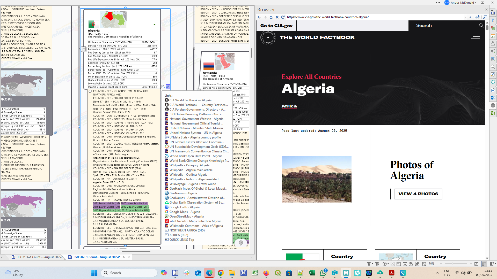
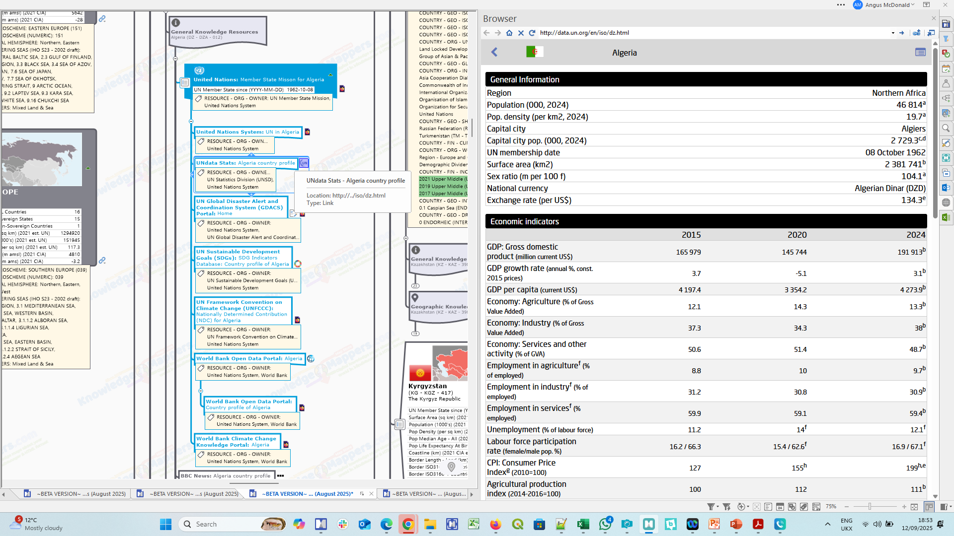
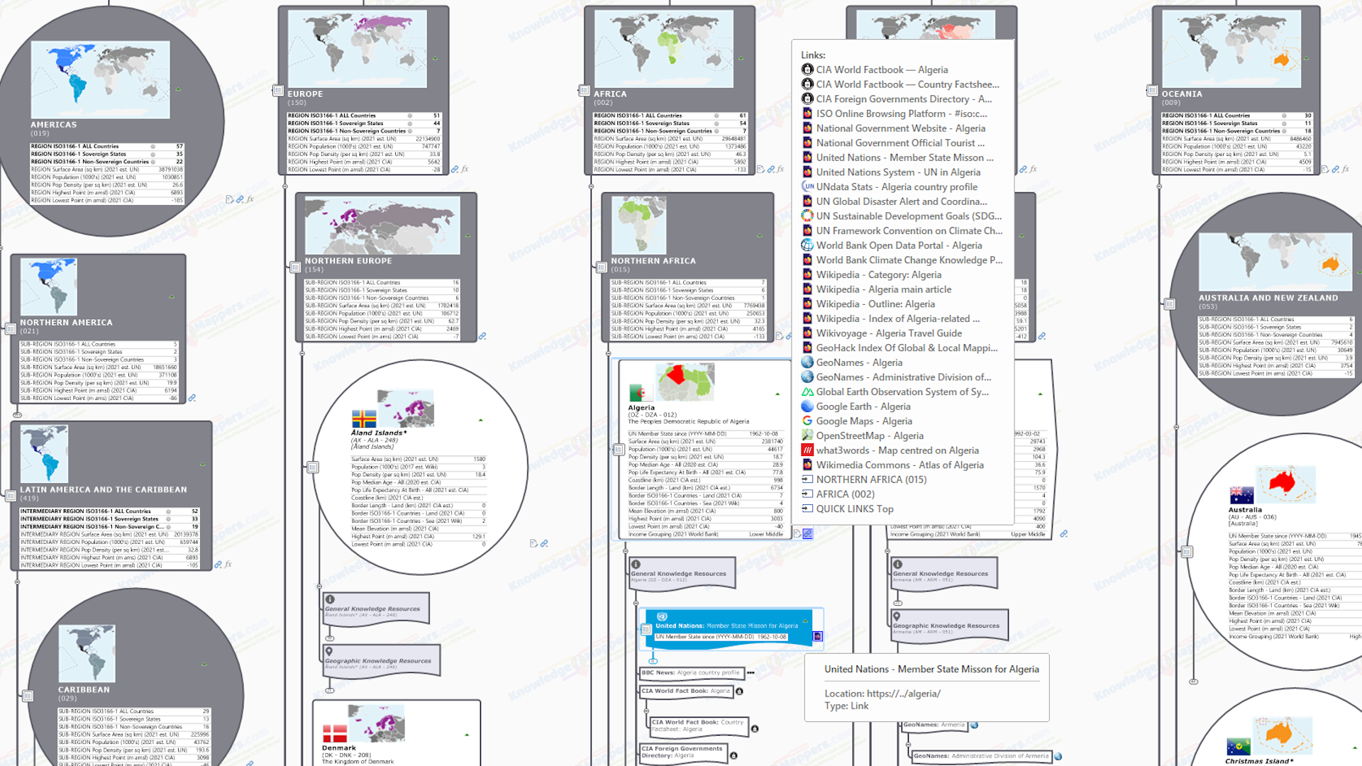
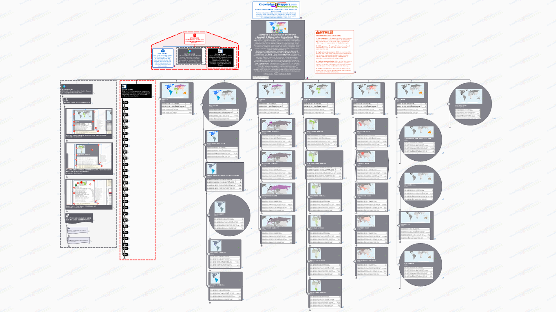
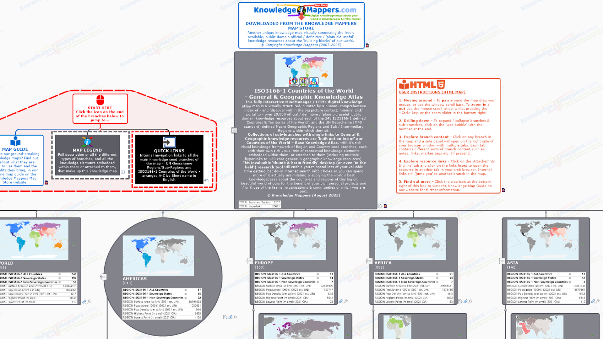
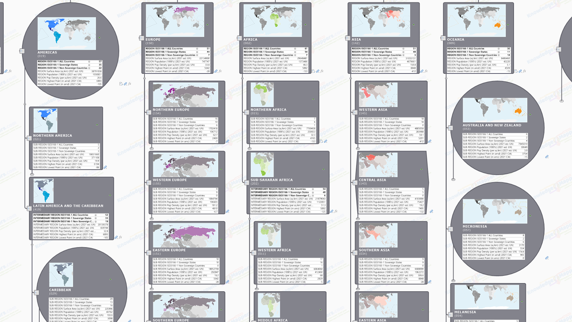
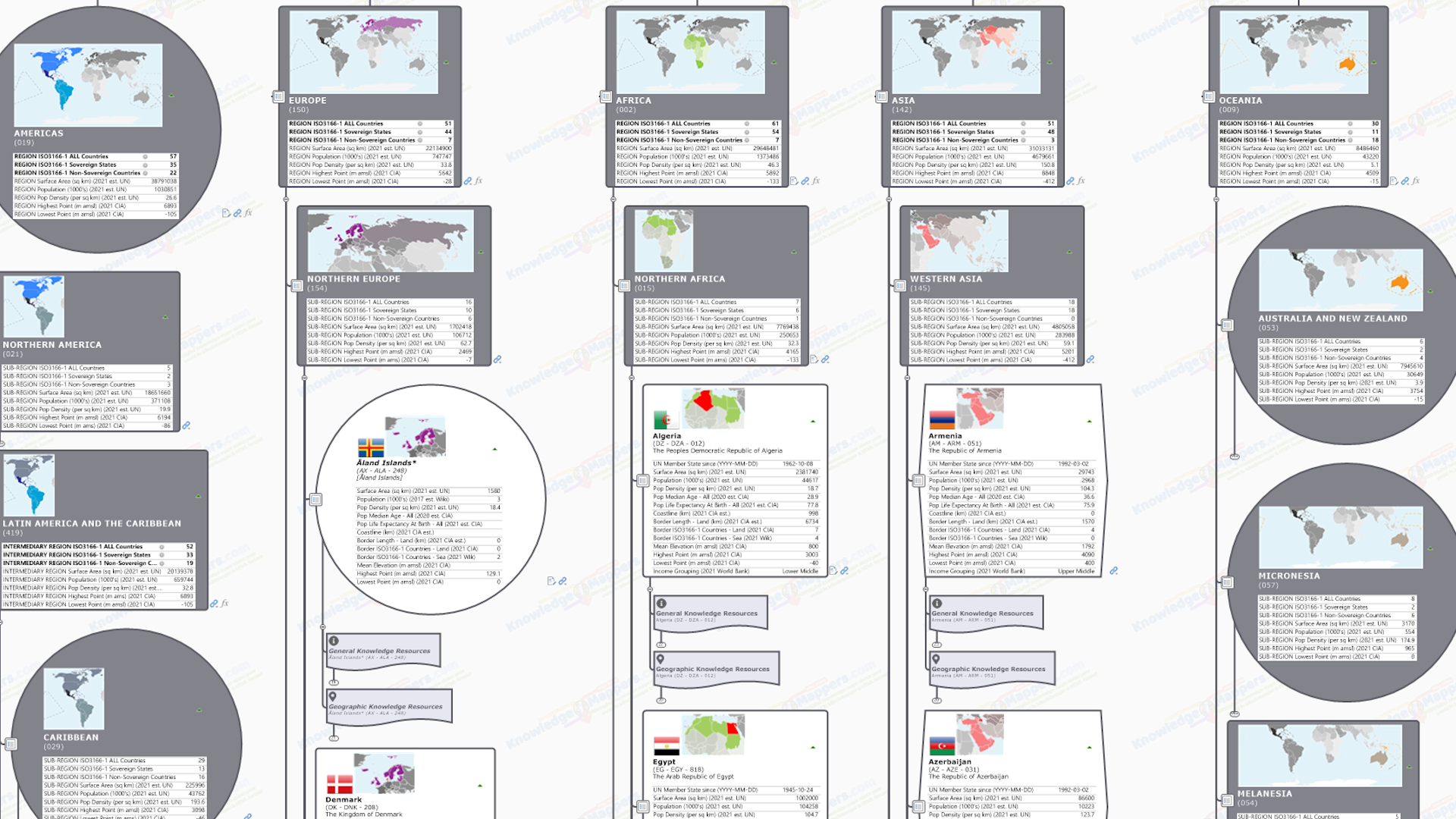
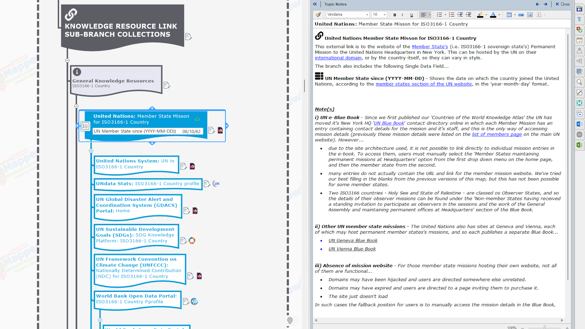
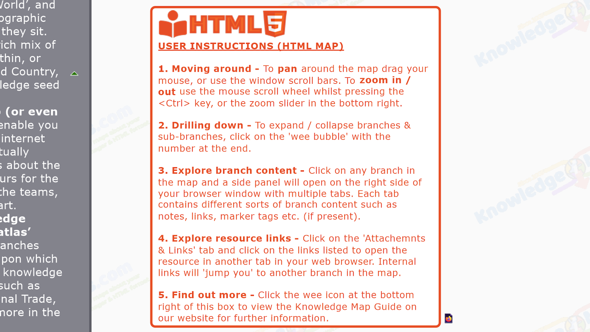
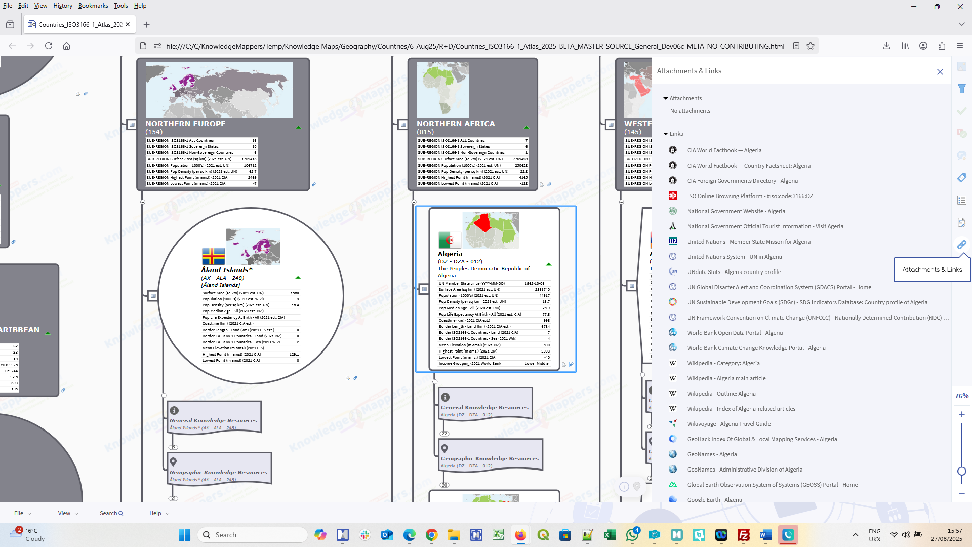
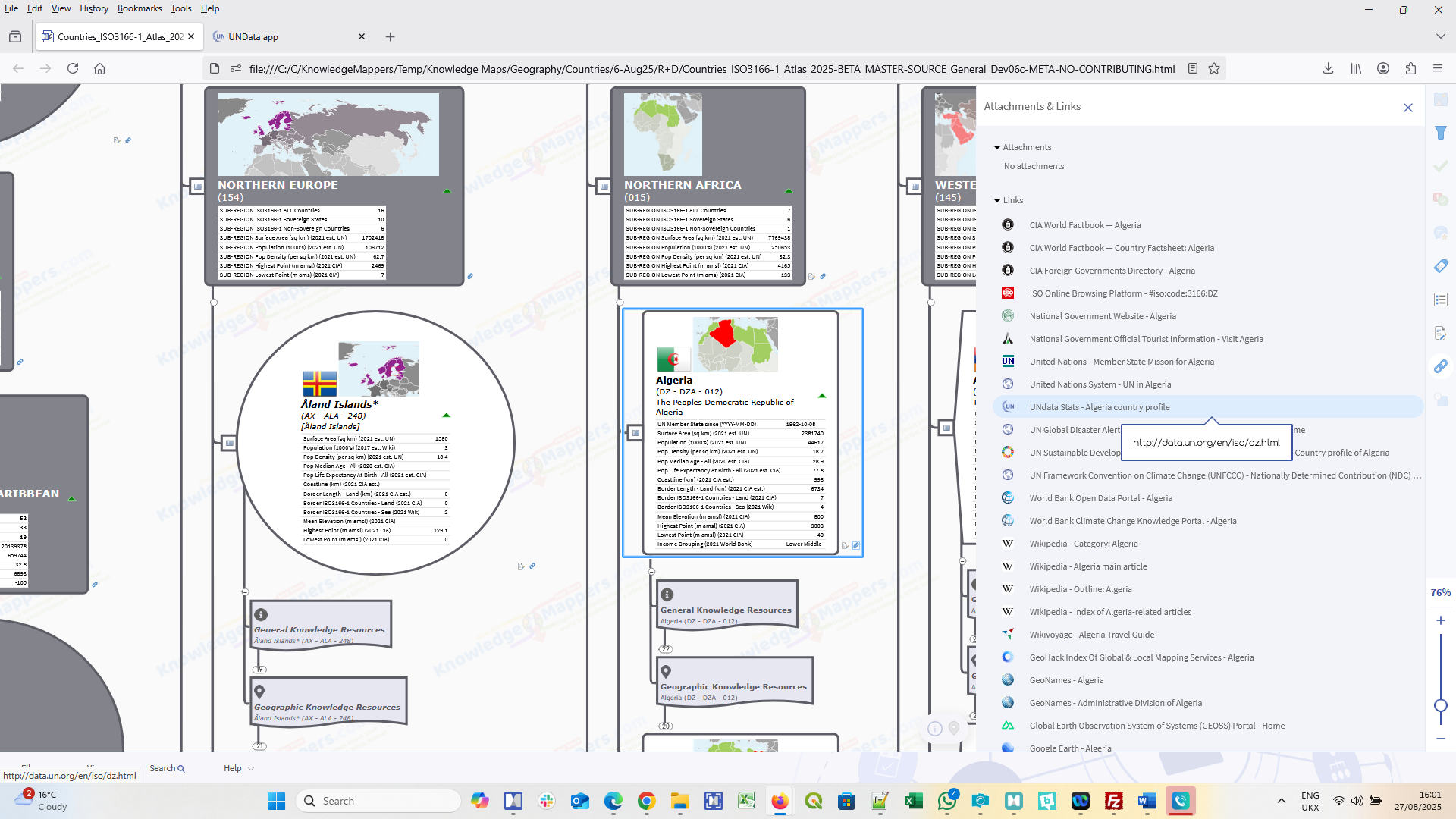
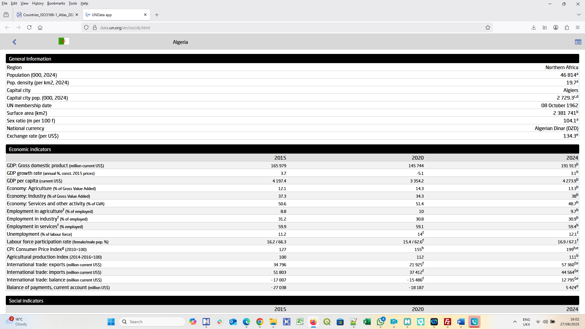
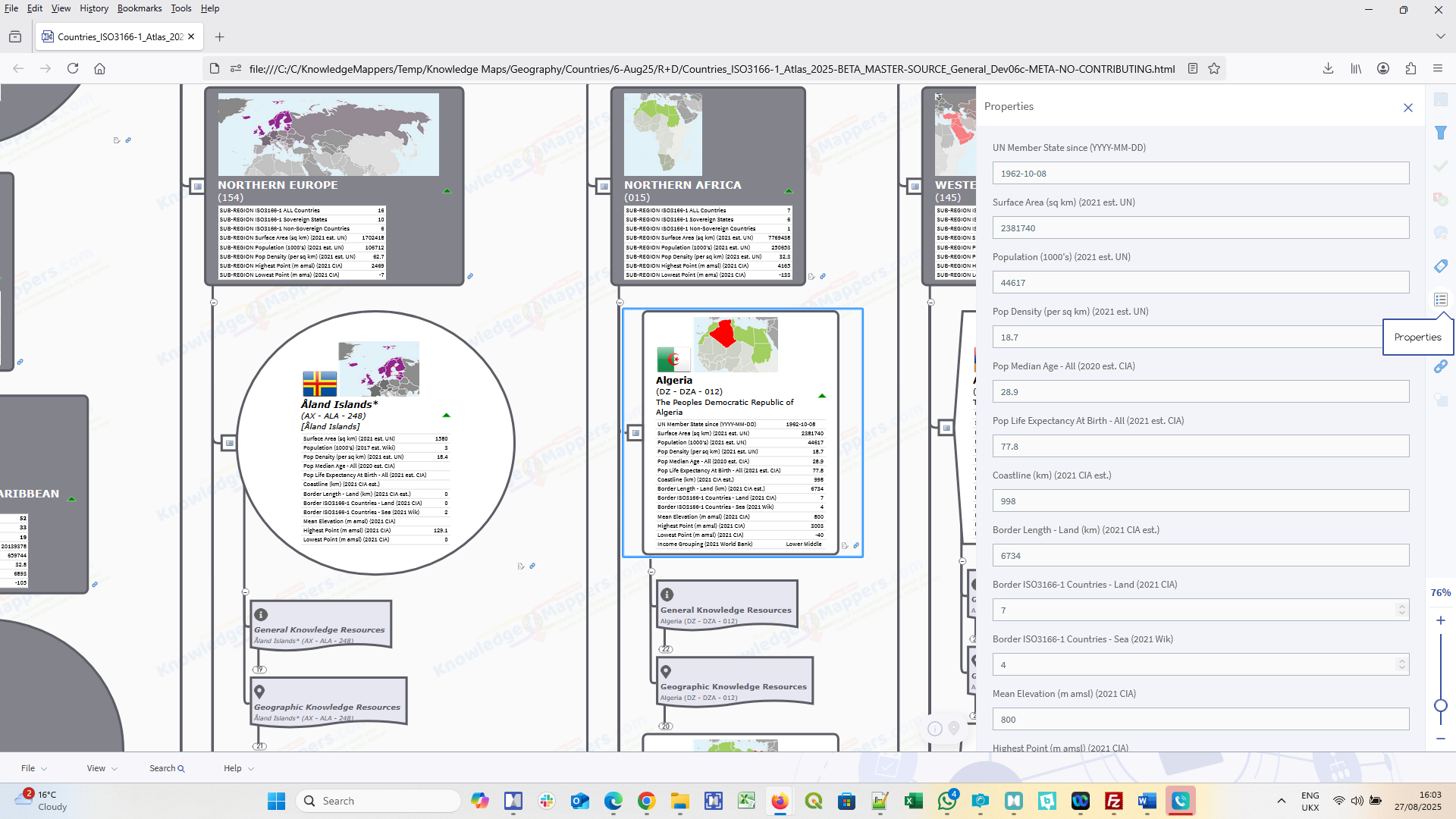
Professionally crafted & curated knowledge maps of real world & conceptual ‘spaces’ of human interest & endeavour. Like all maps, they are visually structured registers of the ‘things’ that define the ‘space’, and the ‘spatial’ relationships between them. But they are also registers of – and portals to – official / definitive / ‘plain old useful’ knowledge resources about those ‘things’ available in the public domain. Maps can be downloaded in both original MindManager (.mmap) and HTML5 format, and so can be viewed in any browser, on any device, without the need for adtitonal plugins.
-
-
-
-
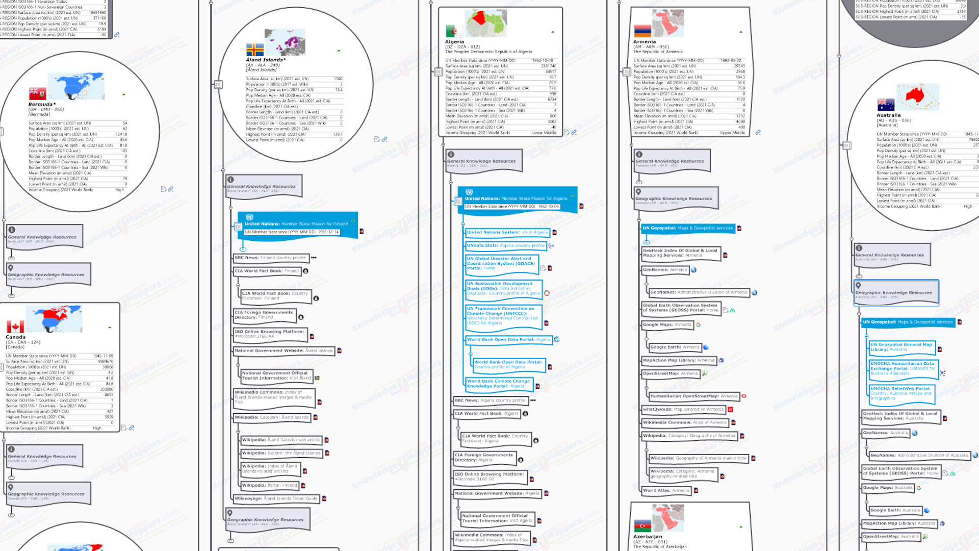
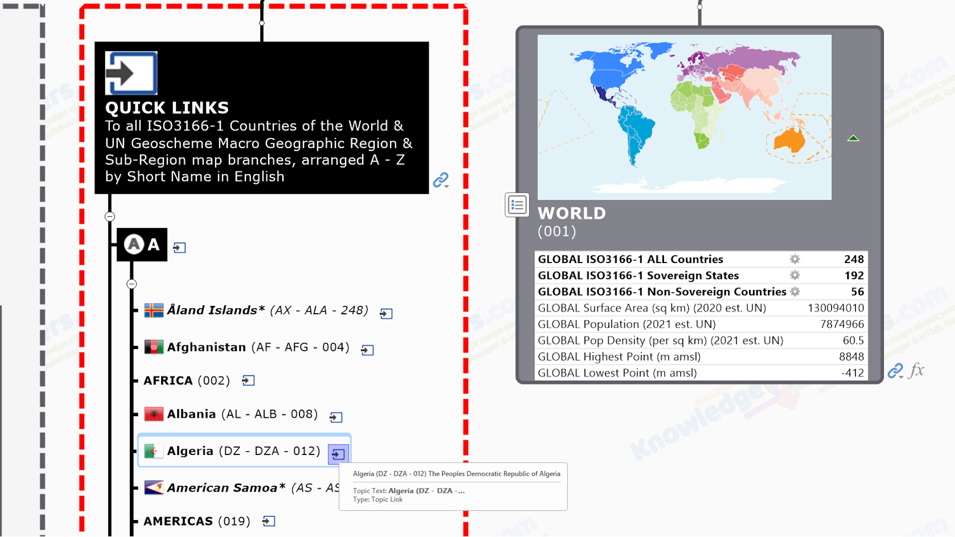
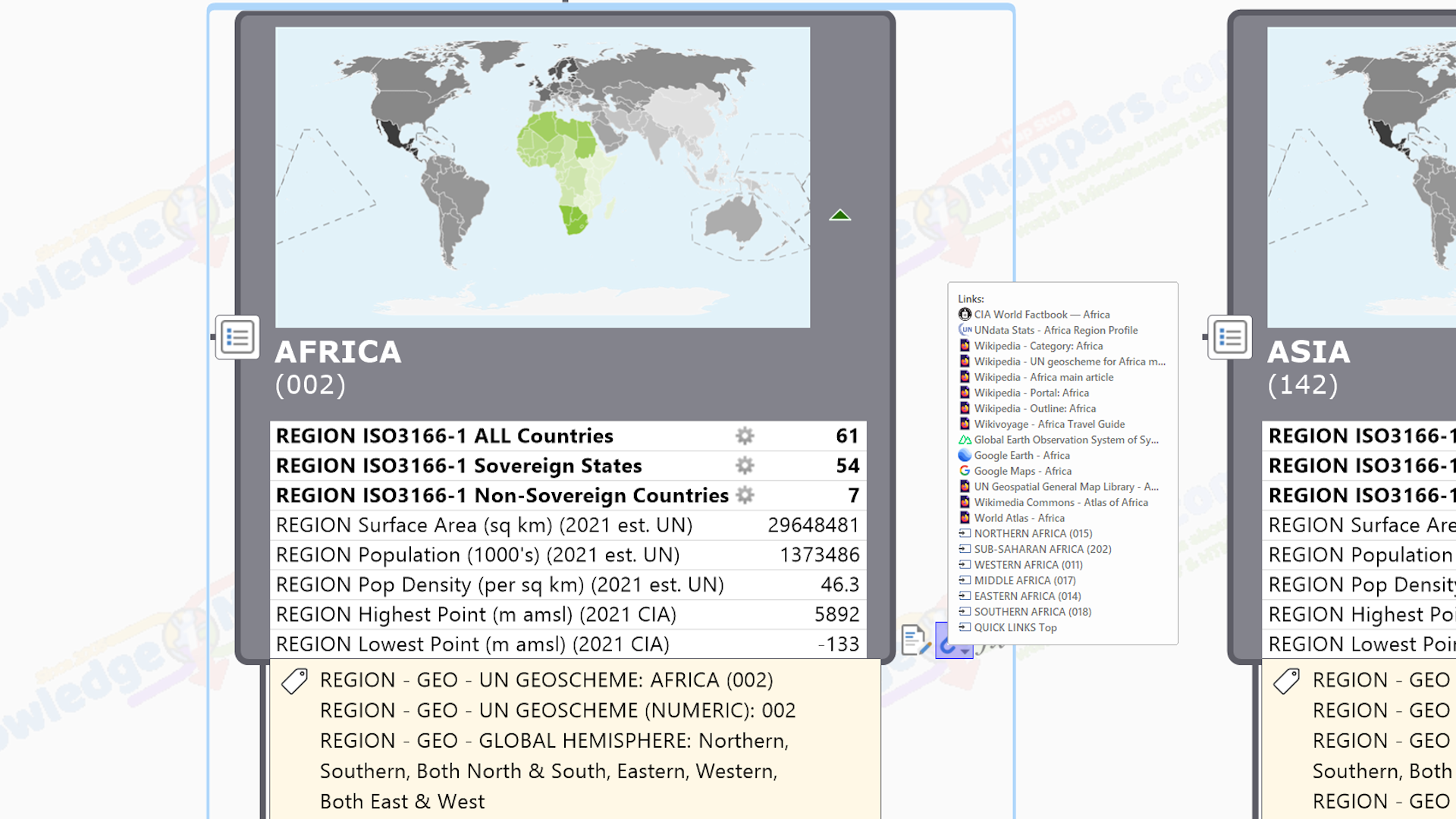
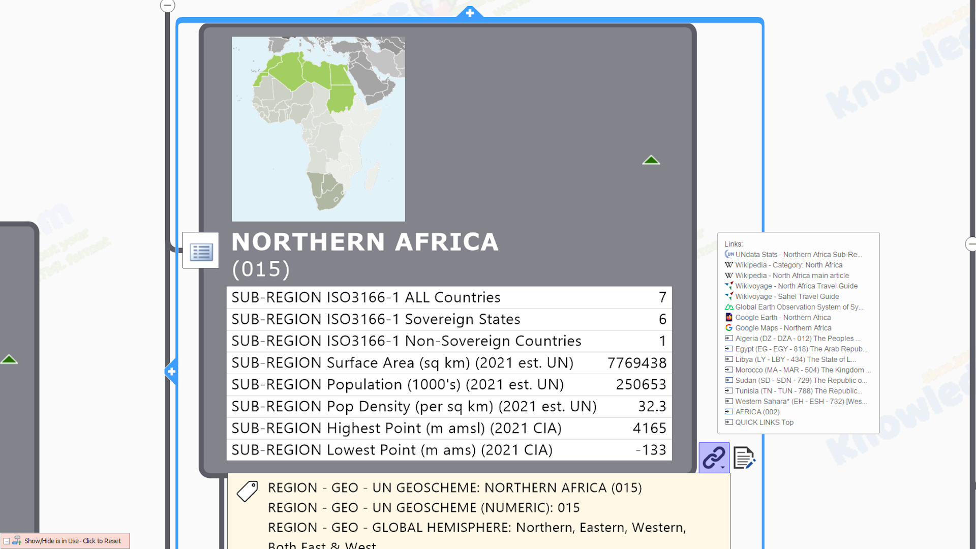
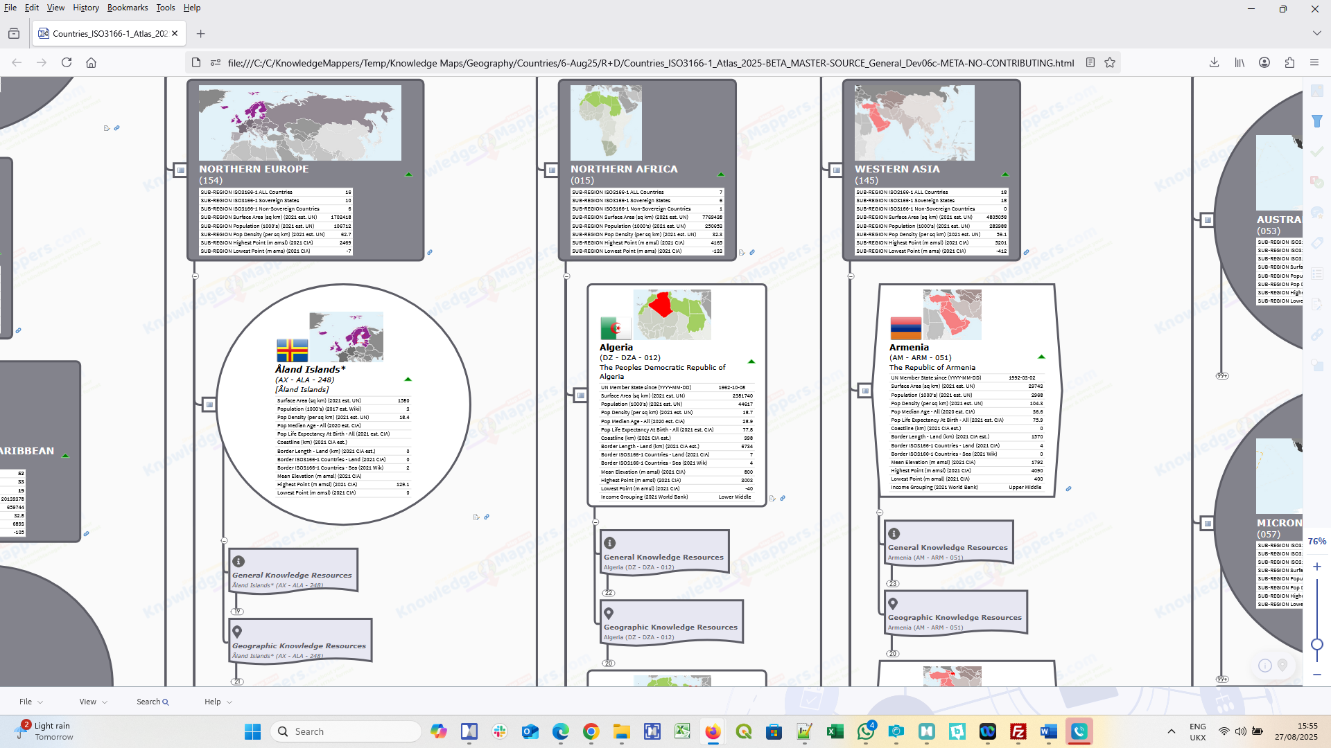
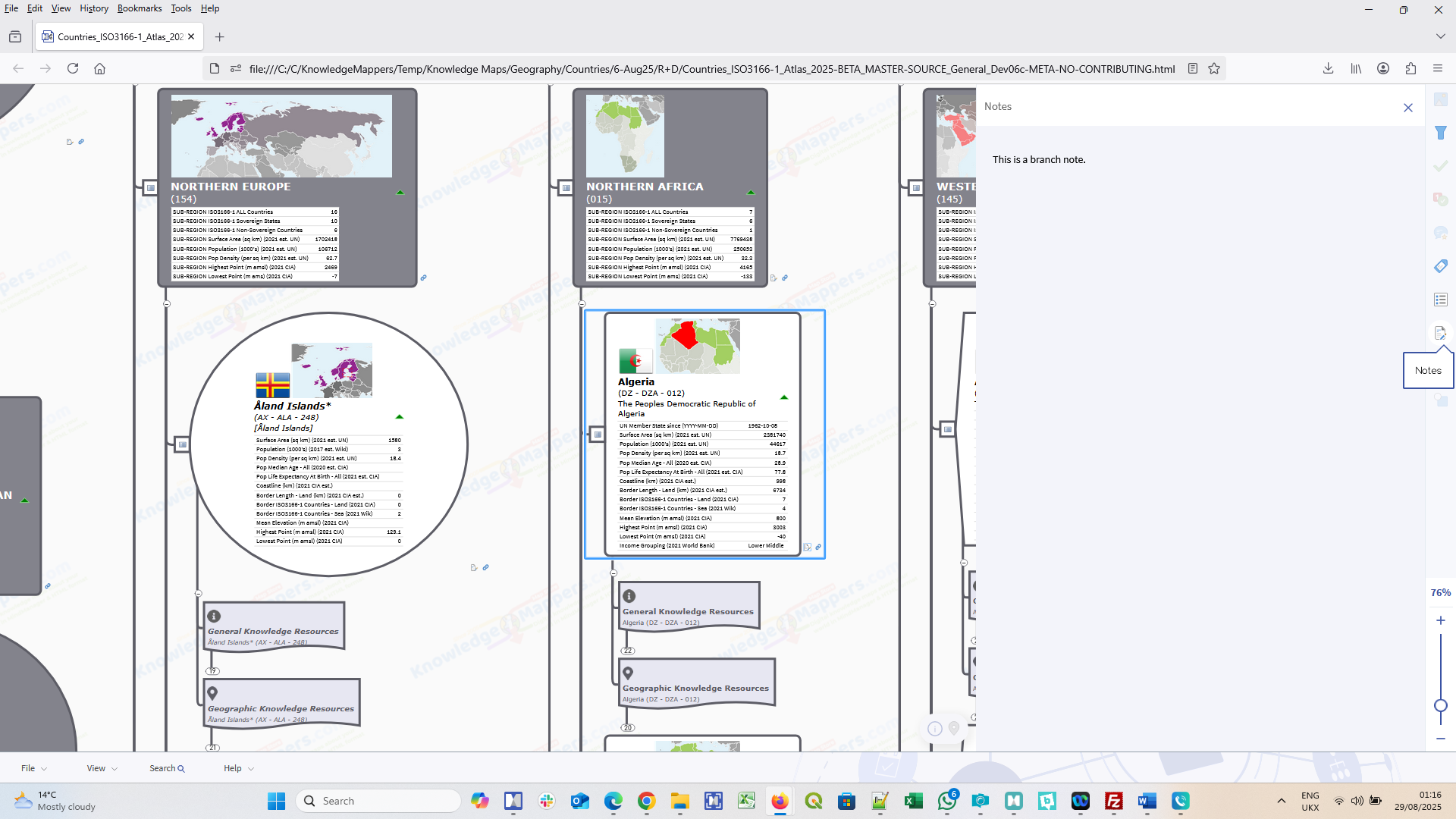
- Geography-Based (Atlas) Maps
- Countries Of The World - Base Knowledge AtlasIn Beta - Coming Soon!
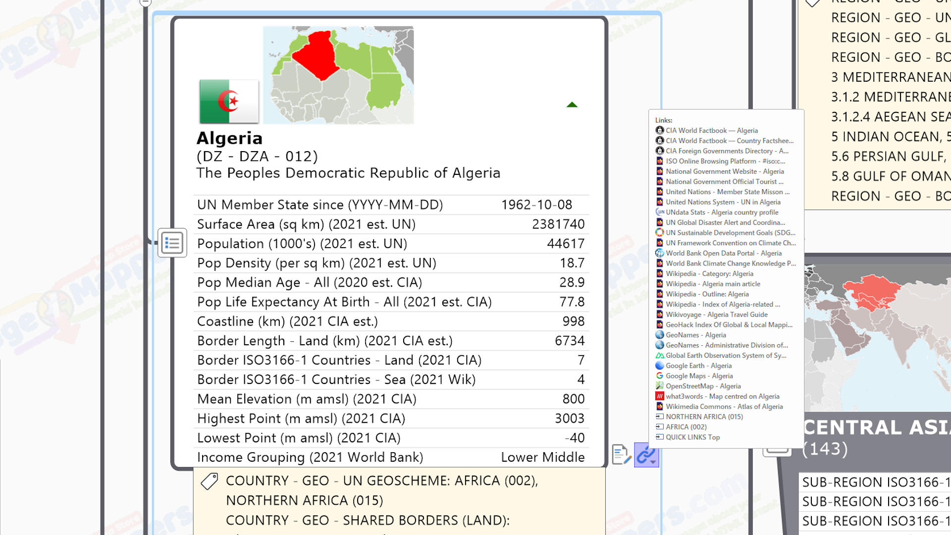
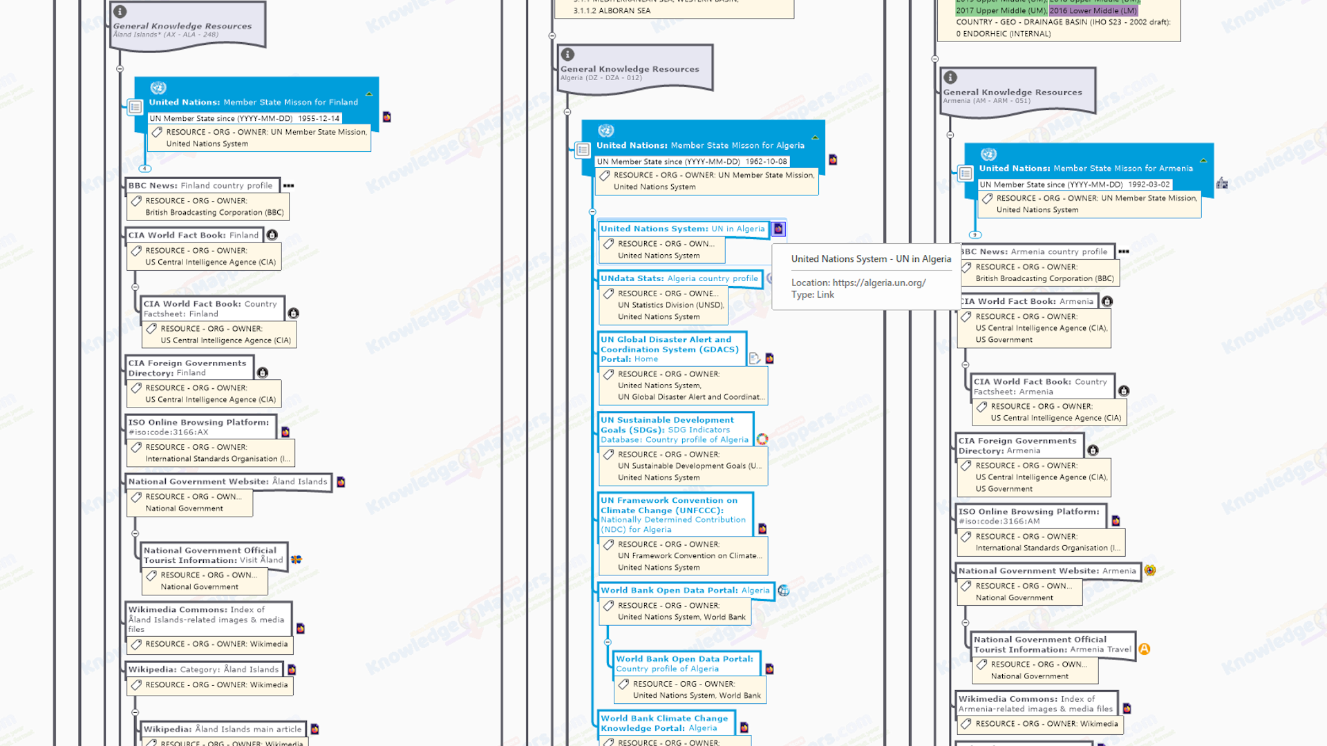
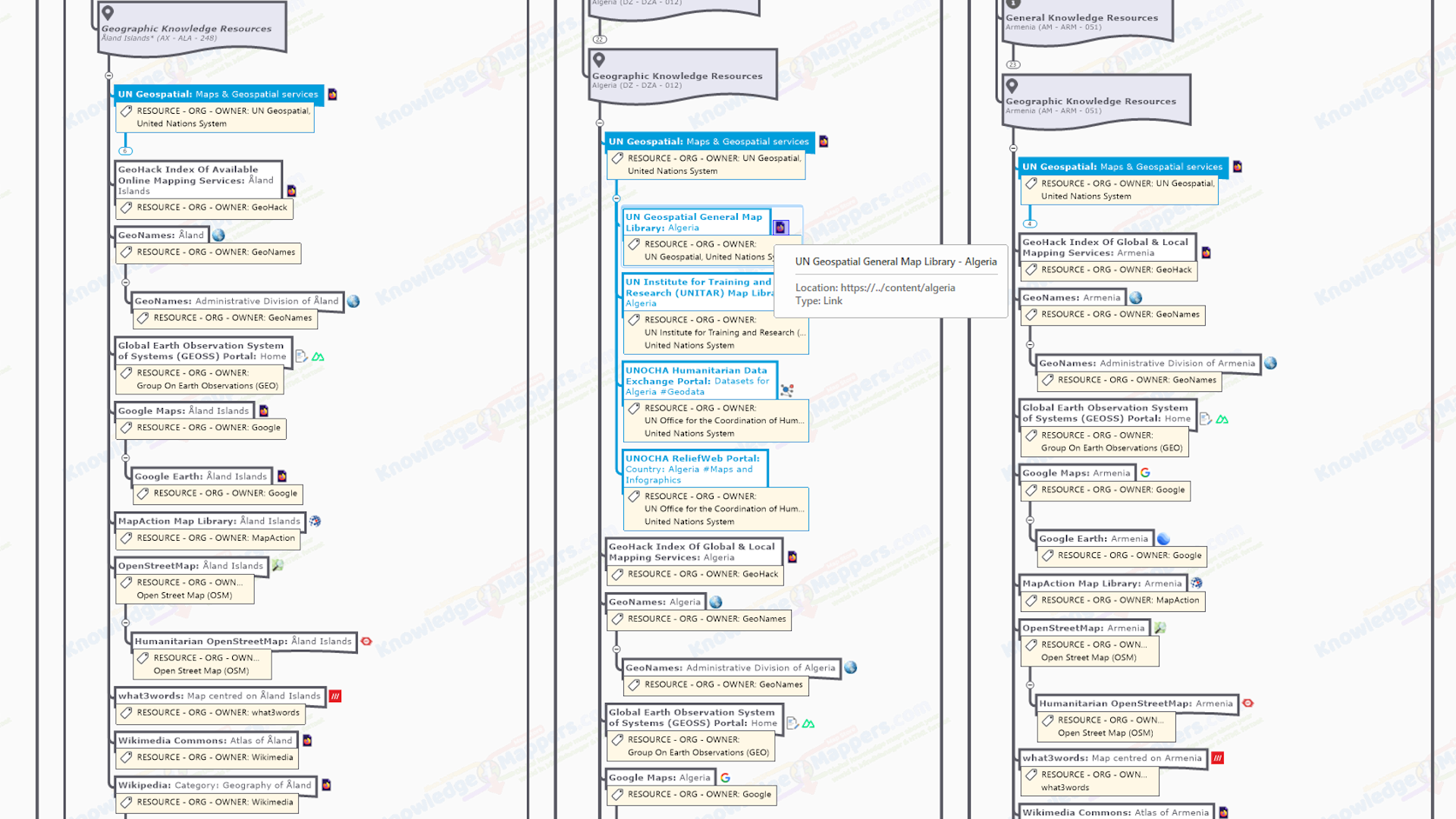
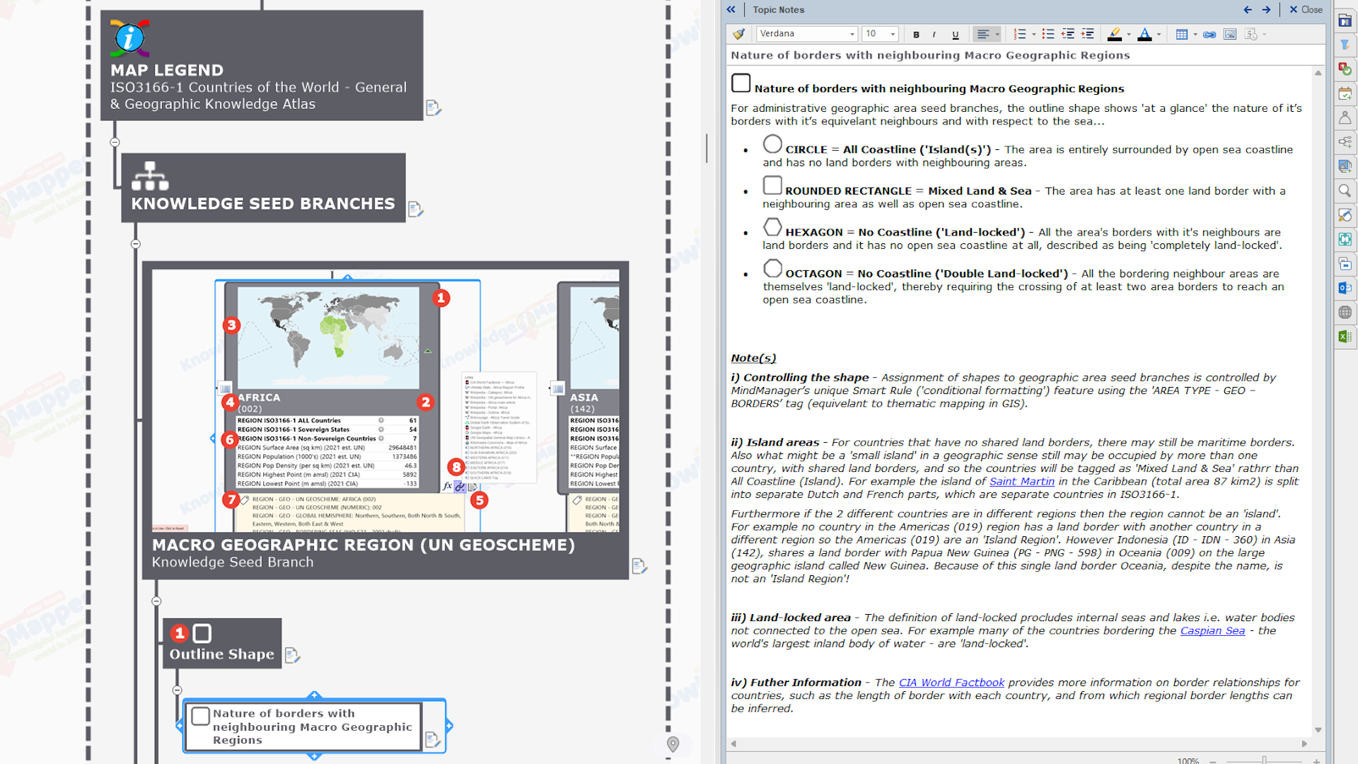
- Countries Of The World - General & Geographic Knowledge AtlasIn Beta - Coming Soon!
- Countries Of The World - International Travellers Knowledge Atlas (General Edition)In Beta - Coming Soon!
- Countries Of The World - International Travellers Knowledge Atlas (GB Edition)In Beta - Coming Soon!
- Countries Of The World - International Trade, Aid & Sustainable Development Knowledge Atlas (General Edition)In Beta - Coming Soon!
- Countries Of The World - International Trade, Aid & Sustainable Development Knowledge Atlas (GB Edition)In Beta - Coming Soon!
- Geography-Based (Atlas) Maps
-
- Time-Based (Calendar) Maps
- Generic Calendars - BaseIn Beta - Coming Soon!
- Annual Calendars - BaseIn Beta - Coming Soon!
- Annual Calendars - World Calendar (General Edition)In Beta - Coming Soon!
- Annual Calendars - World Calendar (GB Edition)In Beta - Coming Soon!
- Annual Calendars - World Calendar (US Edition)In Beta - Coming Soon!
- Time Related TemplatesIn Beta - Coming Soon!
- Time-Based (Calendar) Maps
-
- Cart(0)
- STHC
-
-
-
The School Travel Health Check (STHC) Spatial Analysis Service is an example of a GI consultancy project for one local authority in 2004 that soon “grew arms and legs” to become a ground-breaking, nationally available service. It provides high quality, spatial intelligence to local authorities, school communities and other stakeholders interested in how children travel to school, from where, and how far they travel to get there.
Play VideoPlay Video
-
-
-
- Blog
- Contact


