Knowledge Mappers is a digital mapping consultancy & publishing company with a unique mix of geographic & knowledge mapping expertise. Our ground-breaking products & services visually connect individuals, teams, organisations & communities with the knowledge resources that they need… to do what they need to do… quicker, easier, and with a lot less stress :-)
Professionally crafted & curated knowledge maps of real world & conceptual ‘spaces’ of human interest & endeavour. Like all maps, they are visually structured registers of the ‘things’ that define the ‘space’, and the ‘spatial’ relationships between them. But they are also registers of – and portals to – official / definitive / ‘plain old useful’ knowledge resources about those ‘things’ available in the public domain. Maps can be downloaded in both original MindManager (.mmap) and HTML5 format, and so can be viewed in any browser, on any device, without the need for adtitonal plugins.
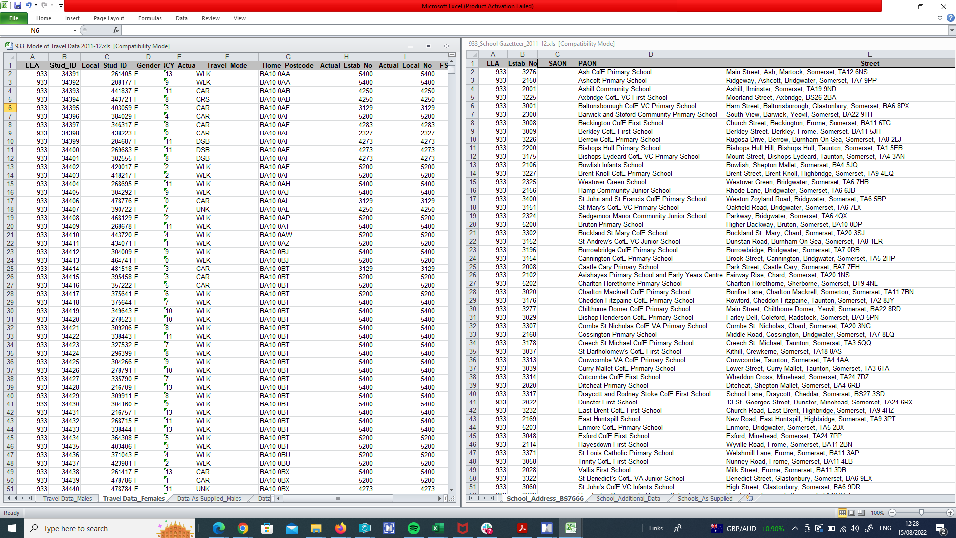
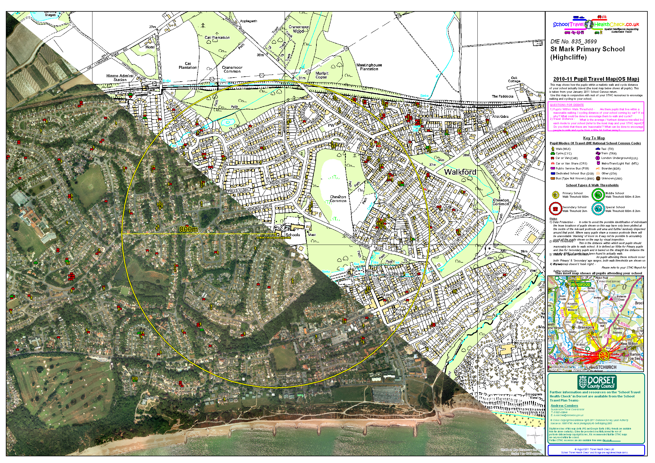
The School Travel Health Check (STHC) Spatial Analysis Service is an example of a GI consultancy project for one local authority in 2004 that soon “grew arms and legs” to become a ground-breaking, nationally available service. It provides high quality, spatial intelligence to local authorities, school communities and other stakeholders interested in how children travel to school, from where, and how far they travel to get there.
Our maps visually connect individuals, teams, organisations & communities with what they need to know… so that they can to do what they need to do… quicker, easier and with a lot less stress!
Knowledge Mappers is a unique, digital mapping consultancy & publishing company. Our ground-breaking knowledge products & services ‘visually connect’ people with what they need to know so that individuals, teams, organisations & communities can do what they need to do to move forward and make their contribution to the world – quicker, easier and with a lot less stress 🙂
Geographic Mapping, Spatial Analysis & Data Portal Services
Our first passion is themapping, analysis and sharing of geographic information (GI) – ie. the knowledge about the ‘places & spaces’ that make up our physical world, and our interactions with them – and we have over 50 years of collective experience covering all aspects…
Indeed our School Travel Health Check (STHC) spatial analysis service – which was born out of an initial GI consultancy project to provide high quality, spatial intelligence data to one local authority, it’s school communities and other stakeholders interested in how children travel to their school, from where, and how far they travel to get there – has been combining all of our GI skills in a nationally available, ‘one-stop shop’ service since 2005.
Our other passion is knowledge mapping, which we do by combining that same unique range of data / information / knowledge hunting & cartographic expertise with Corel (formerly ‘Mindjet’) MindManager – the world’s best information (‘mind’) mapping software – to create multi-function knowledge maps (‘hierarchical tree diagrams’) that visually capture not only the’building blocks’ that make up just about any ‘human knowledge space’ and the ‘spatial’ inter-relationships between them, but also the (potentially 1000’s of) official / definitive / ‘plain old useful’ knowledge resources available about them in the public domain.
And thanks to MindManger’s unique HTML export capability, we can make our ground-breaking knowledge maps available to download in 2 formats from our map store….
Original MindManager (.mmap) format – for full featured viewing, interactive querying, editing, expanding, adapting and re-purposing in whole or in part by MindManager software users.
HTML5 (.html) format – all the content – and most of the interactivity – of the original MindManager map (but ‘view only’), viewable on any any modern browser, on any device, without the need for any plugins, or indeed an internet connection to view it once it has been downloaded (so it can be viewed offline, in remote locations with no signal).
All is made clear in our Knowledge Map Guide. Currently we are concentrating on mapping real world geographic space with ‘atlas knowledge maps of countries of the world’(and our Scotland the Map ‘proof of concept project’ for sub-national spaces), and past, present & future time space with ‘calendar knowledge maps’, but we welcome feedback & suggestionsfor subjects for future maps, or other definitive / official / plain old useful 🙂 knowledge resources to link to (as long as they’re freely accessible in the public domain). We are also keen to collaborate with like minded organisations, communities & projects for the benefit of the common good.
Browse our ground-breaking geographic and knowledge mapping products & services below. In our experience there are very few areas of human endeavor that don’t benefit from the increased understanding, buy-in and alignment amongst stakeholders that working visually brings. You are experts in what you do. Get in touch and let us help you do it better with what we do…
From the UK Chief Medical Officer to Local Council Officers, Project Managers and Headmasters, our mapping products and services have connected many individuals, teams, organisations & communities with the knowledge they need, to do what they need to do… quicker, easier, and with a lot less stress 🙂
This innovative sustainable development initiative [the STHC] aims to provide robust data that will allow schools, planners and individuals to develop more sustainable school travel options.... These statistics provide a useful baseline against which to measure progress, and should be used in conjunction with a qualitative assessment of local authority and school travel policies. [2009 CMO Report]
This work is a rarity - a product from a small consultancy that is motivated by a desire to achieve change and not just to make money. The output is excellent and does help to achieve change. Better still it comes at a very modest price that we cannot match in-house.
The School Travel Health Check is, in my opinion, an invaluable tool for all those interested in improving the health and wellbeing of children. It provides such crucial information that I don't see how we can do without it.
The School Travel Health Check process provides the essential foundations for development and delivery of Sustainable Modes Of Travel Strategies [SMOTS]. The STHC also frees officer time to do the important work of delivering change.
I am managing IT global projects with team members and stakeholders in different countries / continents. This calendar [knowledge map] application enable at a glance to see bank holidays / national / religious events with an explanation in addition. Those explanations are a great facilitator to develop team spirit during our virtual meeting as I can exchange with each attendant on her/his national event.
As a designer I can say without hesitation that Knowledge Mappers were important, unsung heroes, when I was designing The Great Tapestry of Scotland, Scottish Diaspora Tapestry and more recent projects. They provided a fantastic custom-made service in printing out large scale drawings and grids, without this key support it would have the made designing these tapestries more difficult. They also had an attention to detail that was very important. I cannot recommend them enough.
Our School Travel Health Check (STHC) Spatial Analysis Service is cited as the example of best practice for public health in the South West Region in the 2009 Annual Report of the UK Government Chief Medical Officer (see “Increasing active travel by schoolchildren” – p73).
“This innovative sustainable development initiative aims to provide robust data that will allow schools, planners and individuals to develop more sustainable school travel options.”
“Active travel to school is an important source of physical activity for young people. It could be increased further. These statistics provide a useful baseline against which to measure progress, and should be used in conjunction with a qualitative assessment of local authority and school travel policies.”
Here are some of the reasons why our unique range of knowledge / information / data mapping skills & expertise can help you do what you need to do… quicker, easier and with a lot less stress…
0+
Years Of Experience
We have decades of collective professional experience of all aspects of the sourcing, creation, analysis & sharing of information to provide meaningful insight to stakeholders.
Insight, Not Technology
Though technology is vitally important, it is just a tool, a means to an end. We never lose sight of the reason why we are using it, which is to provide you with meaningful insight into your world...
Standard Office Tools
We use the same standard technology tools as you - MS Office, MapInfo, QGIS, Google Maps, MindManager, Bootstrap, browsers... It's what we do with them that makes the difference!
Friendly & Approachable
We like to work in a collaborative way with our clients and partners so that we achieve more together. You are experts at what you do. We would like to help you do it better with what we do 🙂
Pragmatic Approach
We've been employees in the public sector and large corporations ourselves, so we know what it's like from both sides. That's why we offer things like 'flexible invoicing' to fit in with your budgetary cycle.
We Hate Waste
The wasting of your time hunting for the information you need. The waste of effort in creating knowledge resources that aren't as well used as they could be by those who would benefit from them most. We're doing our best to sort that!
MindManager Official Partners
As one of MindManager's International Value Added partners we feed in to the Beta development program and can draw from a huge pool of knowledge to help you get the most from the world's best information mapping software.
We're On The Supplier List
We are on several government supplier lists, including the Scottish & UK governments, as well as local authorities. Let us know if there's anything we can do to make procurement of our products & services any easier for you.
Community Benefit Focus
Community is what binds us together as a species. It is through community that probelms are identified, solutions arrived at & delivered, and success celebrated & shared. We especially enjoy working with communities (geographic or virtual) to help them move forward with what they want to do.
To know that we know what we know, and to know that we do not know what we do not know, that is true knowledge.
Nicolaus Copernicus
16th Century Mathematician & Astronomer
Tae ken that we ken whit we ken, and tae ken that we dinnae ken whit we dinnae ken, that's whit it's aw aboot, ye ken?
Rab C. Nesbitt
Contemporary Scottish Philosopher
And whilst we're aboot it, tae ken where the hell ye get haud of whit ye need to ken, when ye need to ken it, if ye dinnae ken it awready?
Rab C. Nesbitt
Contemporary Scottish Philosopher
As well as the definitive list of 'building blocks' of our world, our knowledge maps are a visually structured portal to all the official / definitive / plain old useful knowledge resources to be found about them in the public domain. All in a single shareable HTML file, viewable by anybody on any device with a browser. Not bad, ken?
Angus McDonald
Knowledge Mappers Founder & CEO and Scotland The Map Project Director
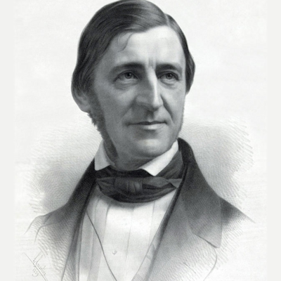
Do not only go where the path may lead, go instead where there is no path and leave a trail.
Ralph Waldo Emerson
Philosopher and Transcendentalist
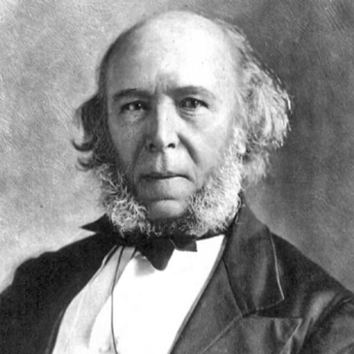
So the task is, not so much to see what no one has yet seen; but to think what nobody has yet thought, about that which everybody sees.
Arthur Schopenhauer
German philosopher and author of The World as Will and Representation
A map is the greatest of all epic poems. It's lines and colours show the realisation of great dreams.
Gilbert Hovey Grosvenor
'Father of Photo-Journalism' & 1st Full-Time Editor Of National Geographic Magazine
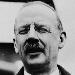
The great aim of education is not knowledge, but action!
Herbert Spencer
English Philosopher, Psychologist, Biologist, Sociologist, Anthropologist and all round Polymath
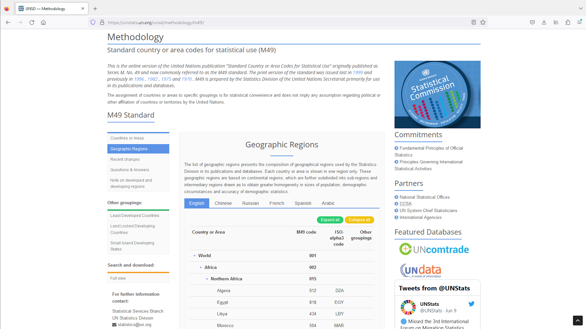
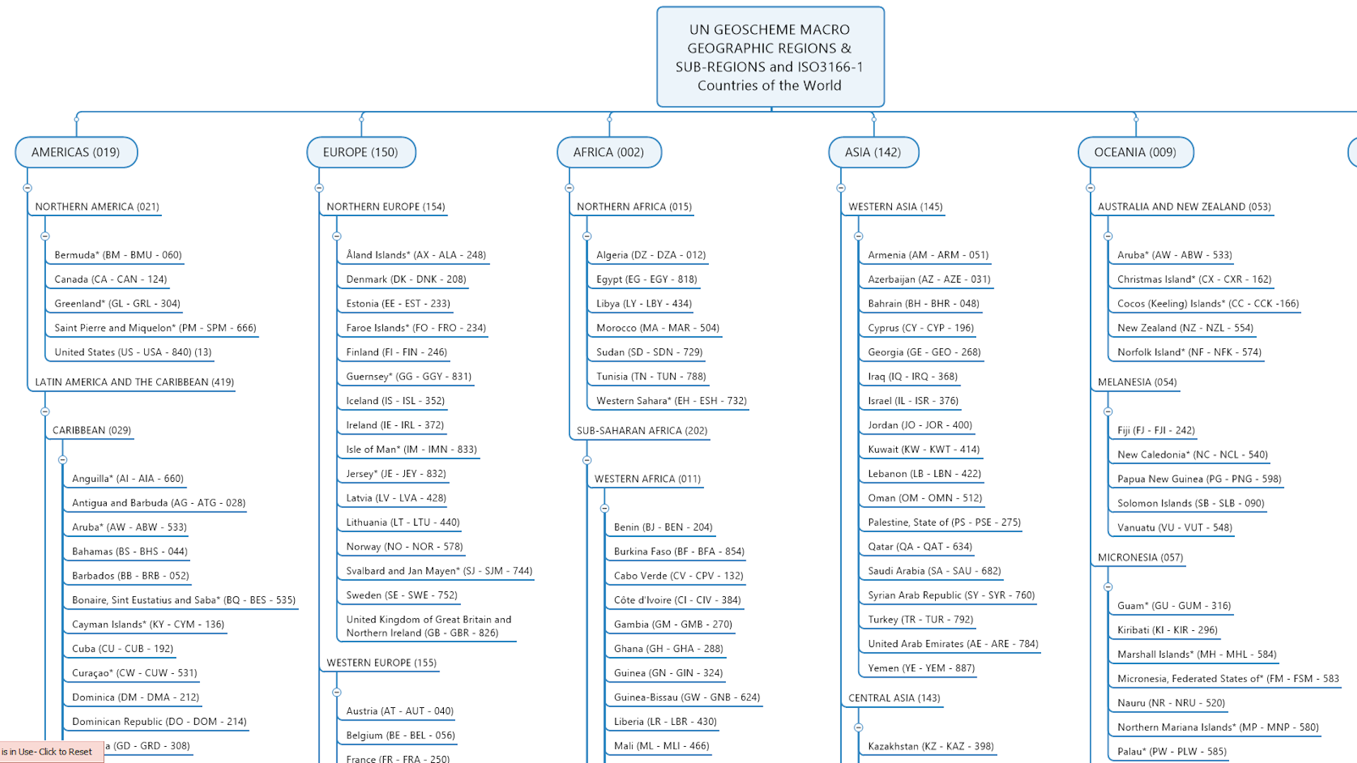
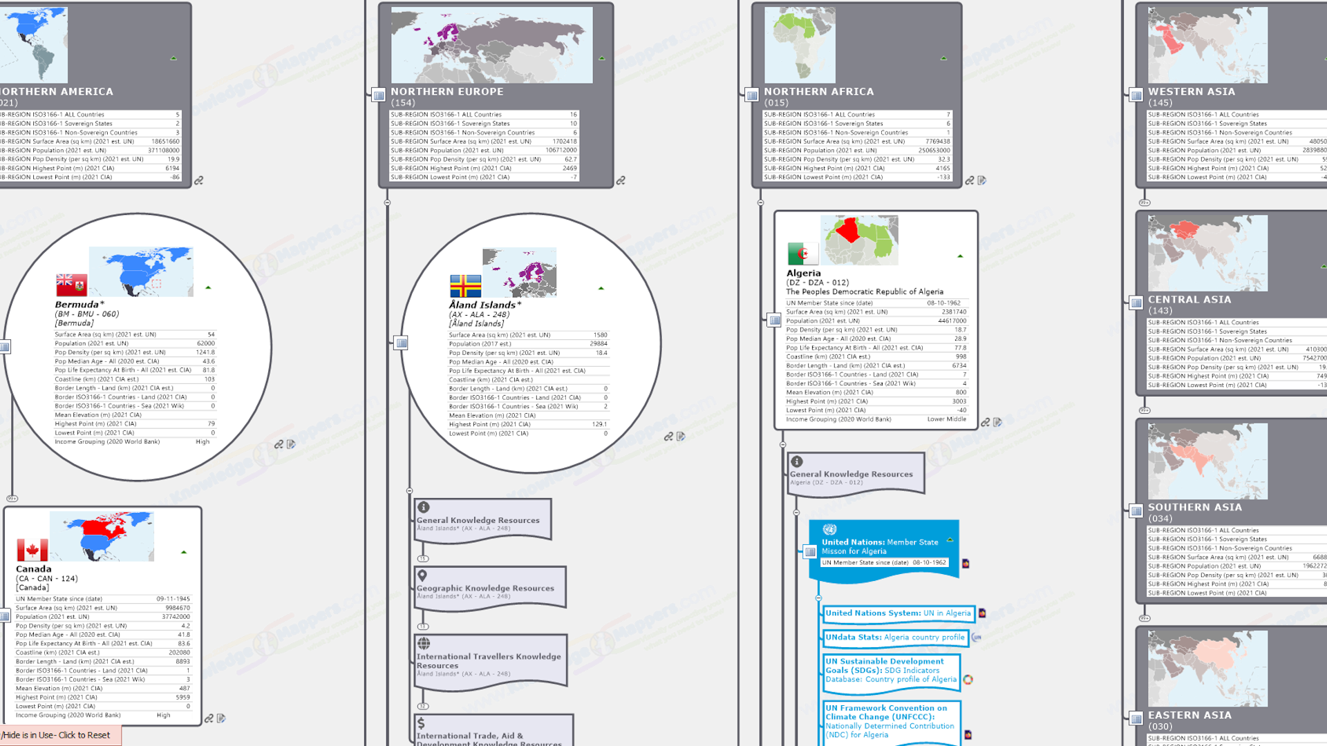
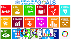
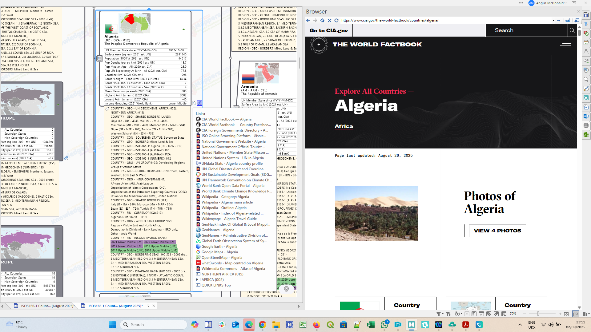
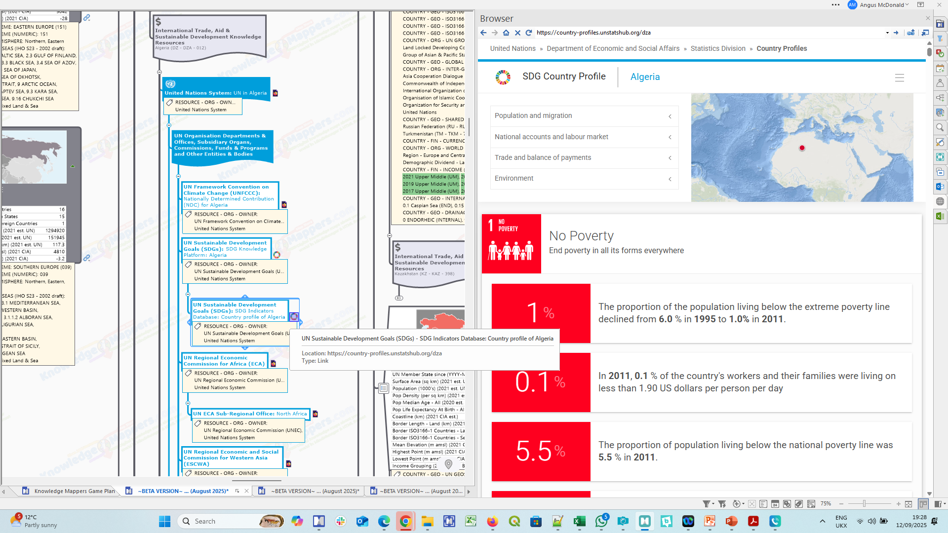
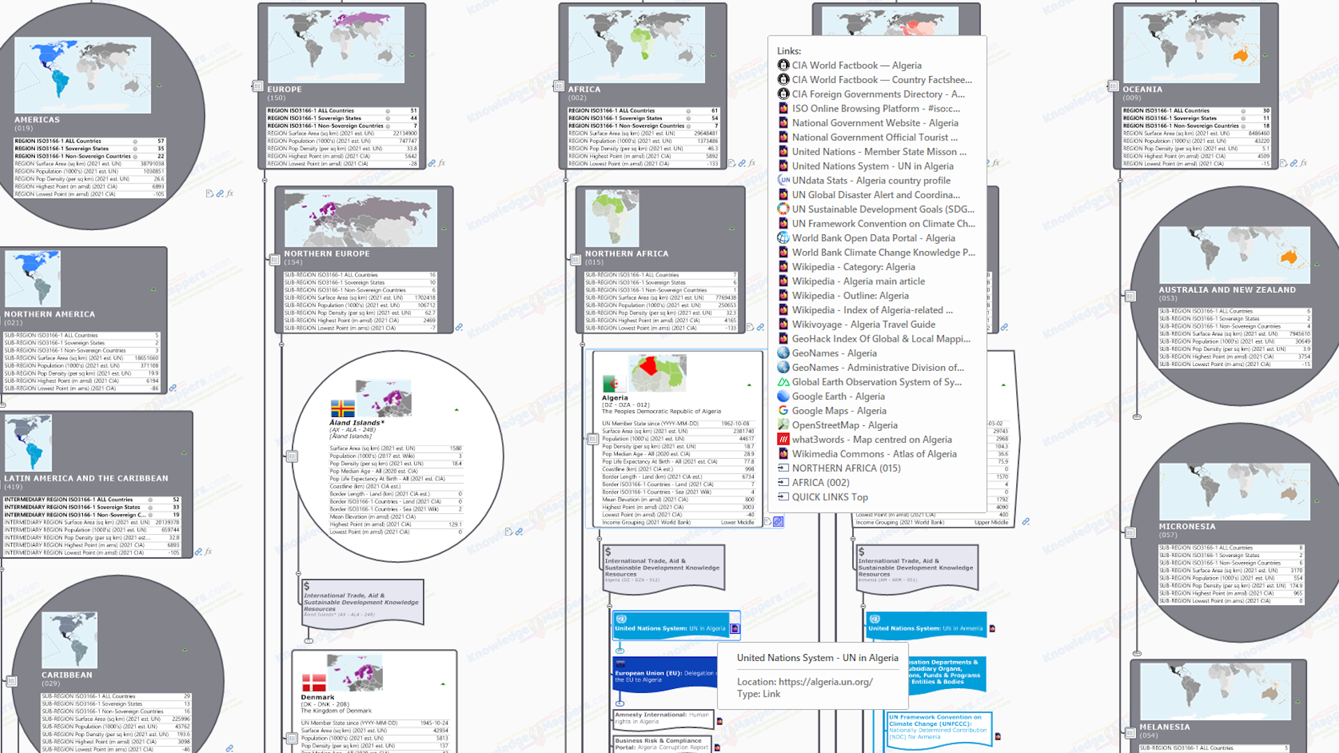
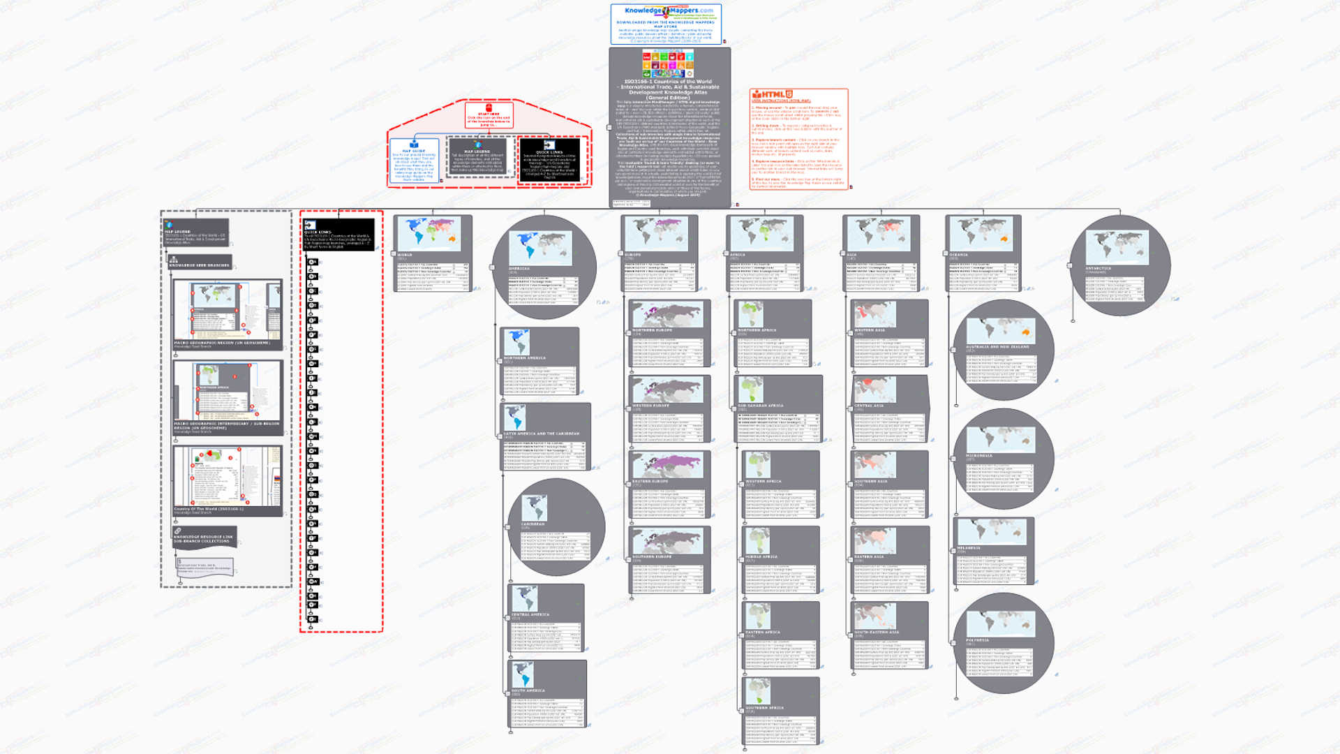
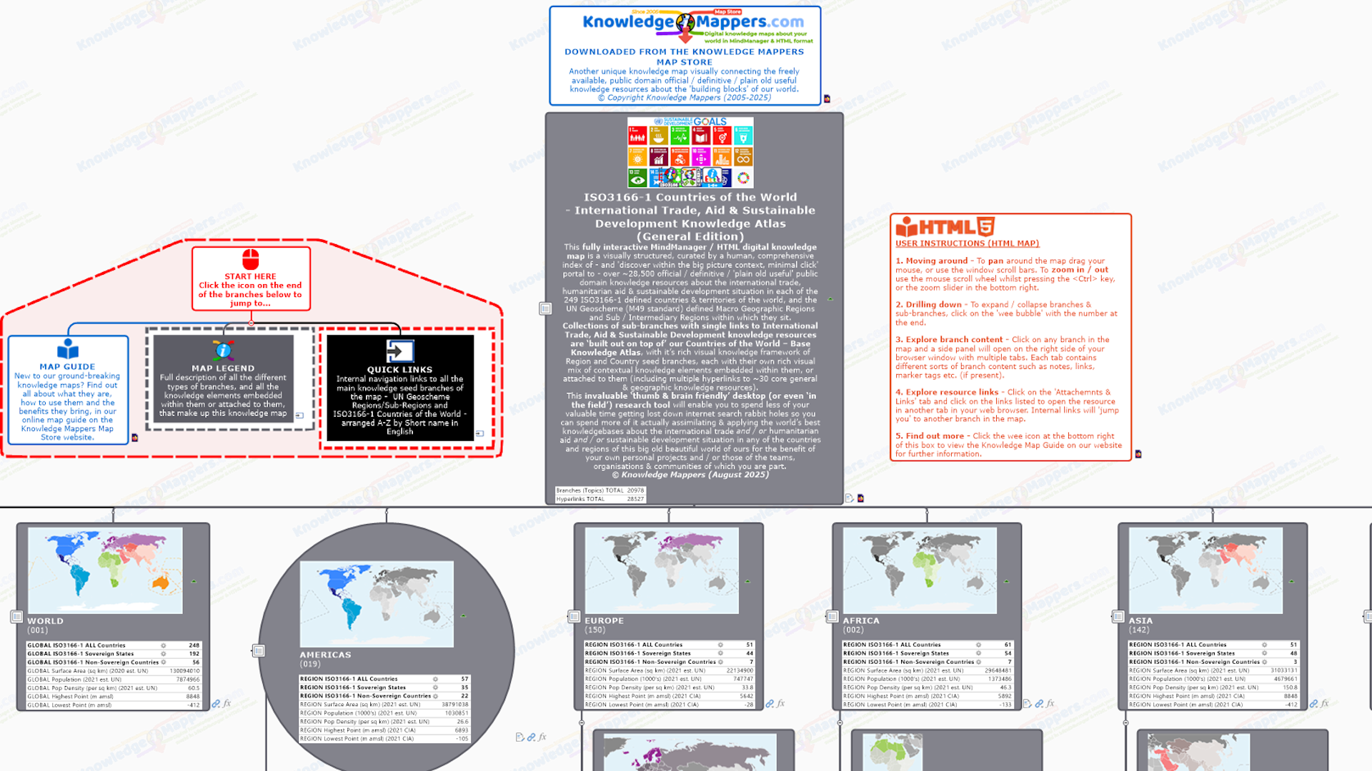
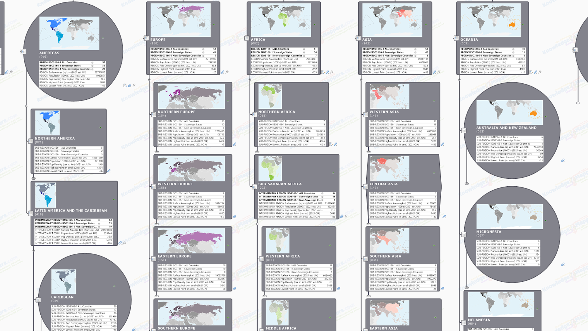
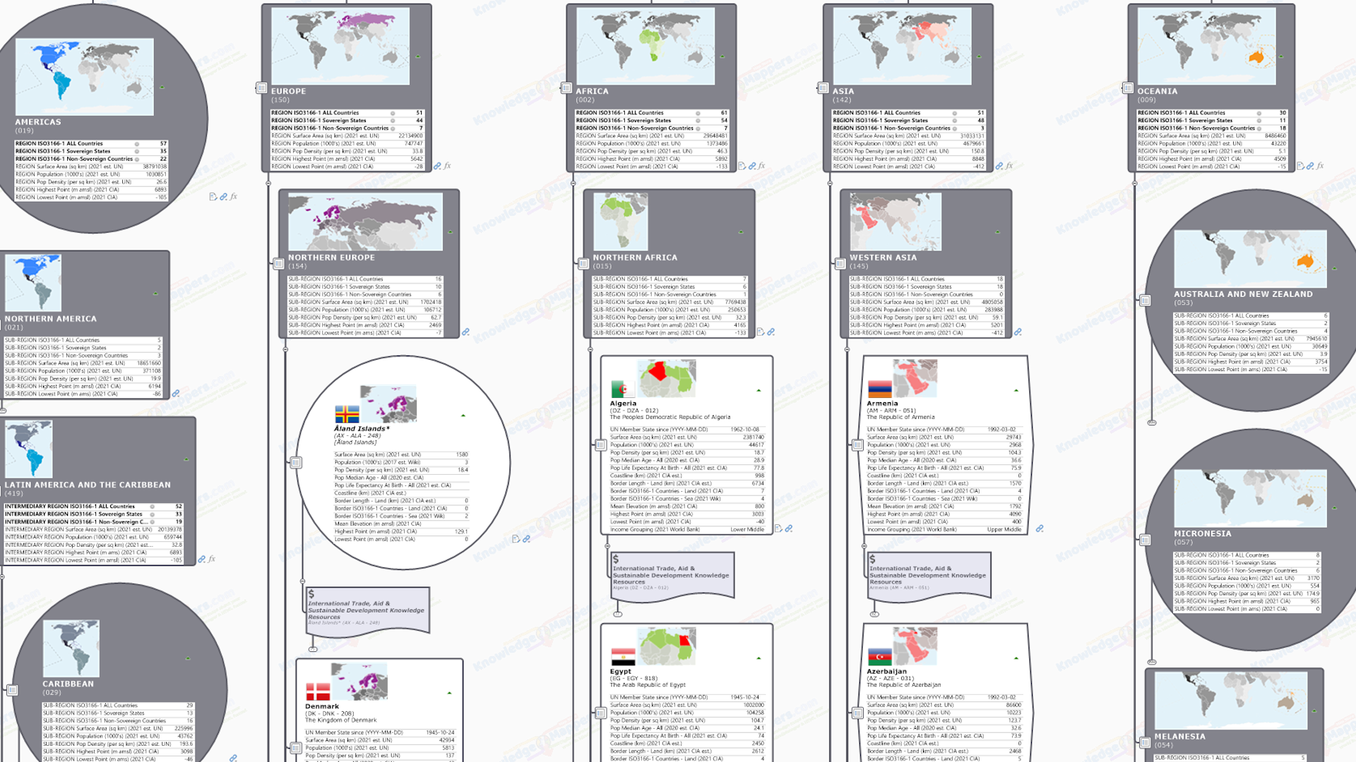
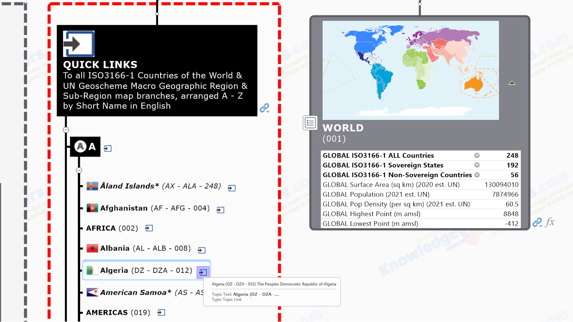
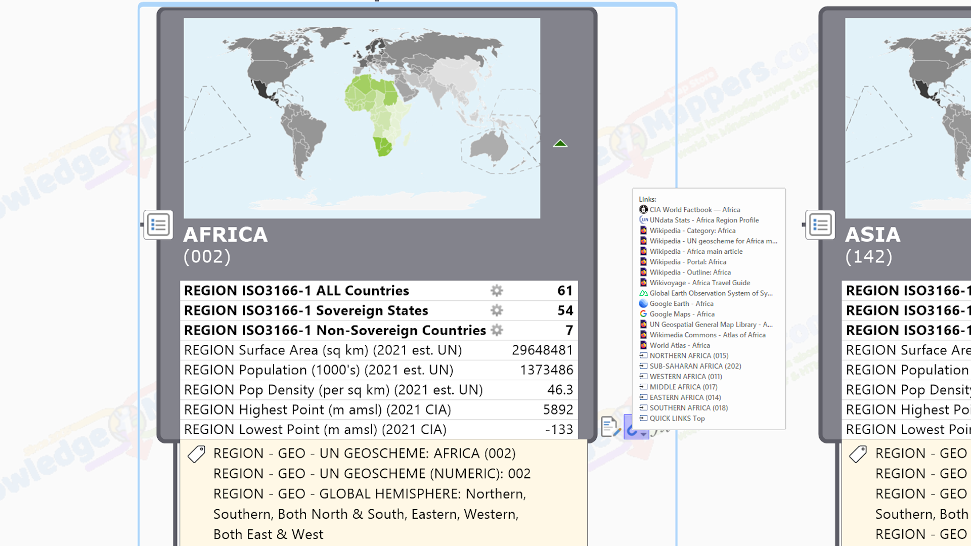
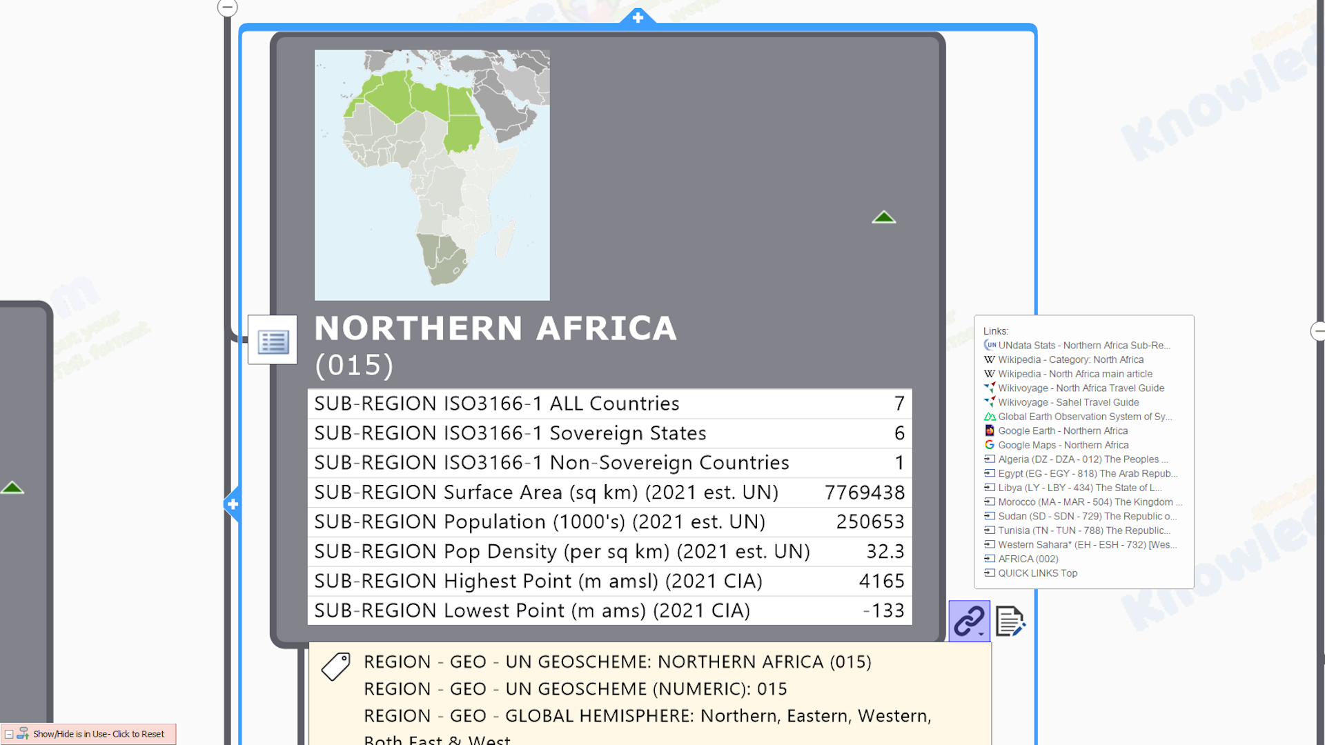
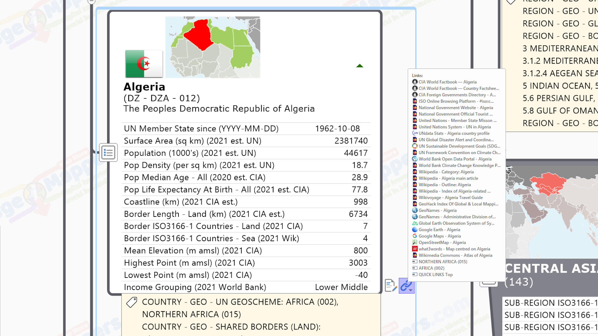
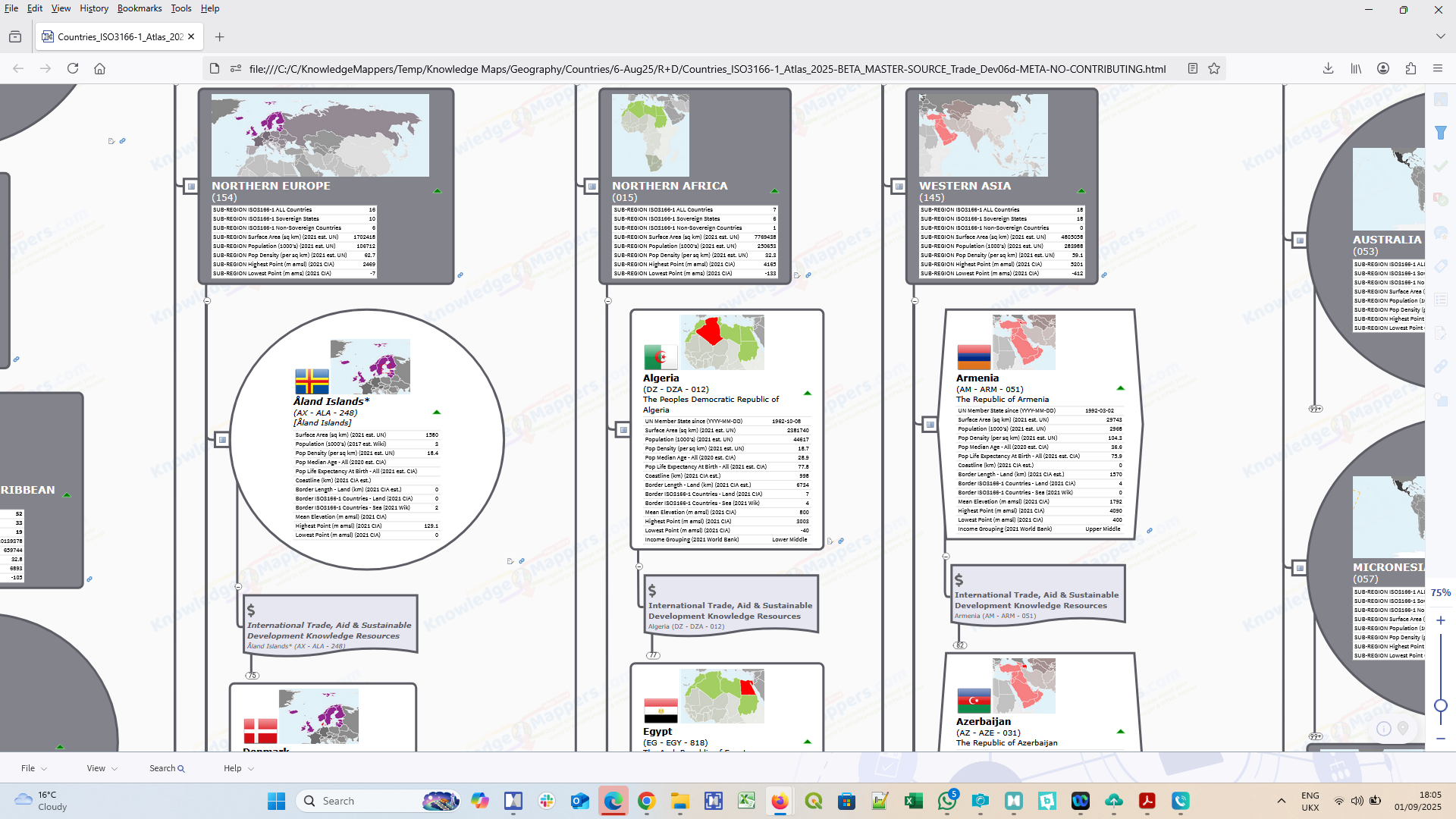
Our Countries of the World – International Trade, Aid & Sustainable Development Knowledge Atlas (General Edition) is a visually structured, curated by a human, comprehensive index of – and ‘discover within the big picture context, minimal click’ portal to – over 28,500 official / definitive / plain old useful, public domain knowledge resources about the international trade, humanitarian aid & sustainable development situation in each of the 249 ISO3166-1 defined ‘Countries & Territories of the World’, and the UN Geoscheme (M49 standard) defined Macro Geographic Regions and Sub / Intermediary Regions within which they sit.
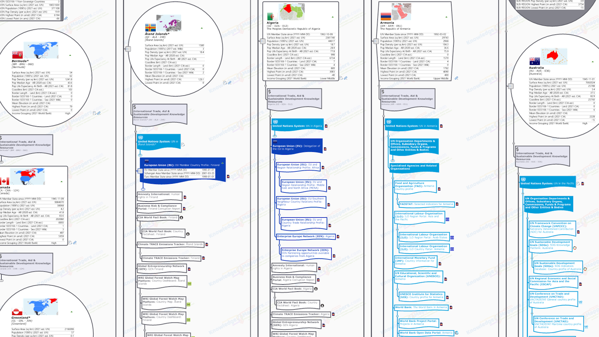
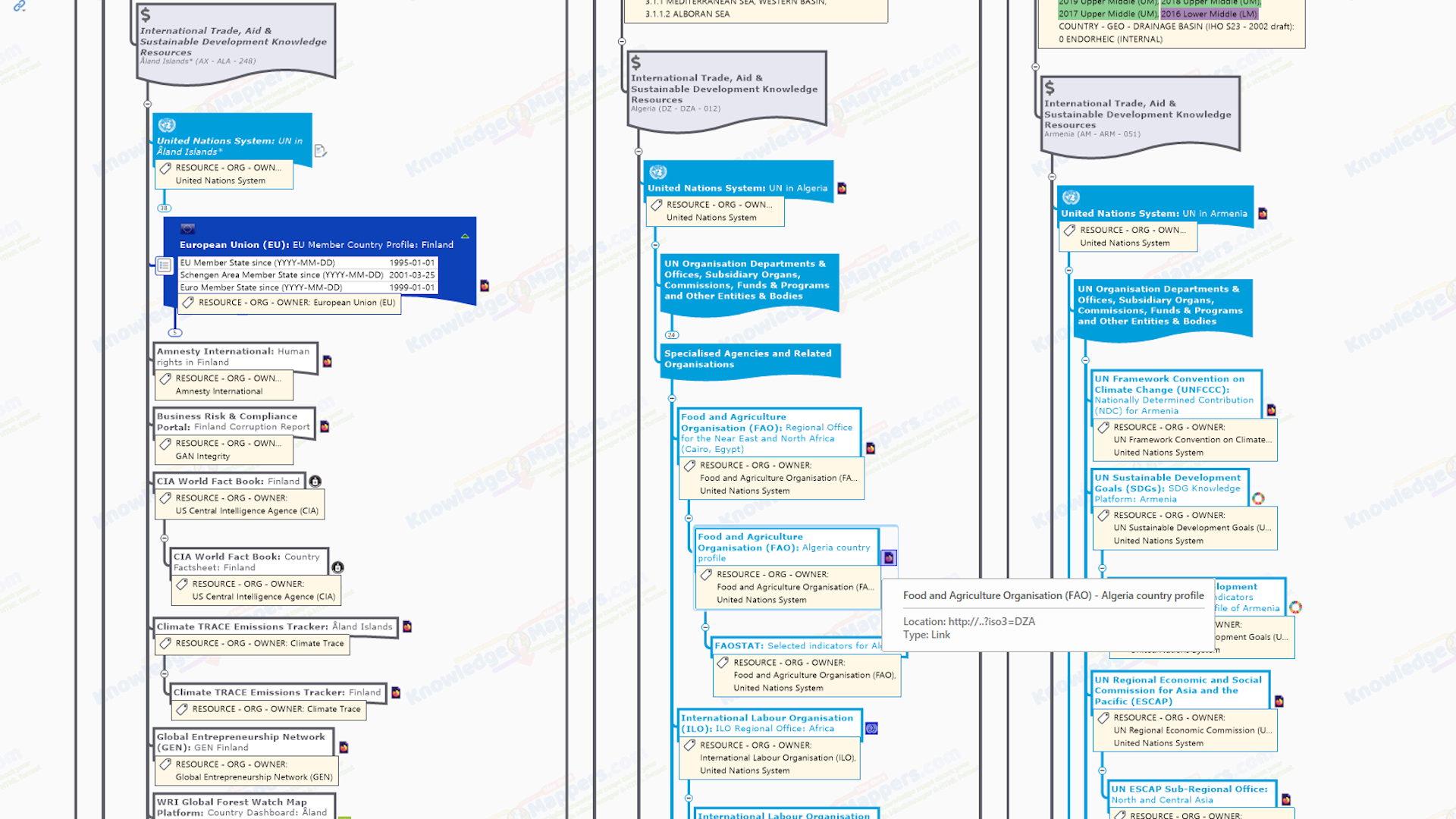
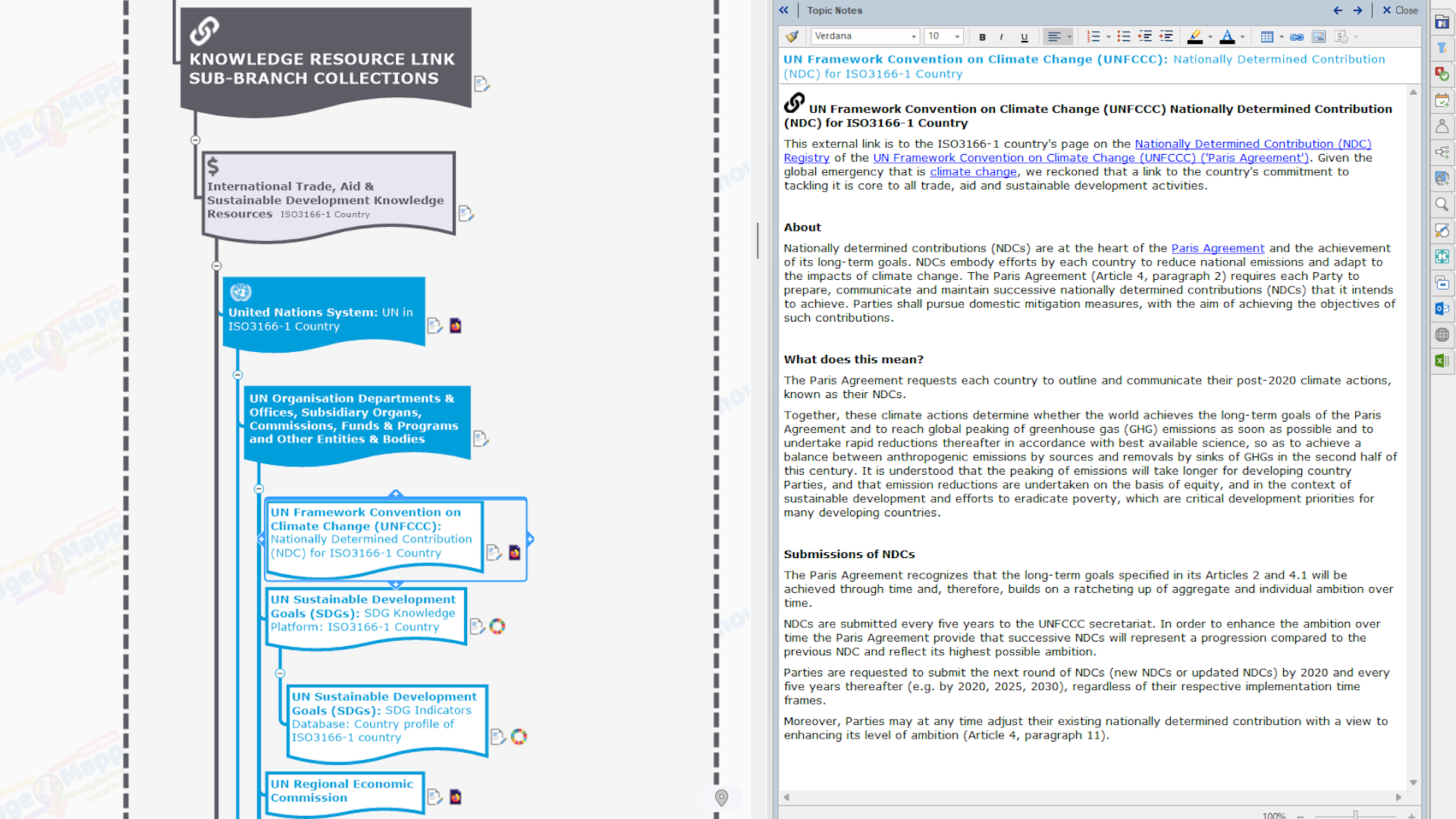
It builds on the knowledge framework provided by our ISO3166-1 Countries Of The World – Base Atlas through the addition of collections of knowledge resource links sub-branches ‘built out on top of’ the country seed branch, each with a single hyperlink to official / definitive / plain old useful knowledge resources about some aspect of the International Trade, Humanitarian Aid or Sustainable Development situation in it found in the public domian….
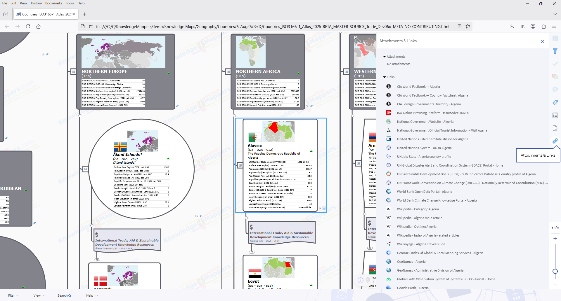
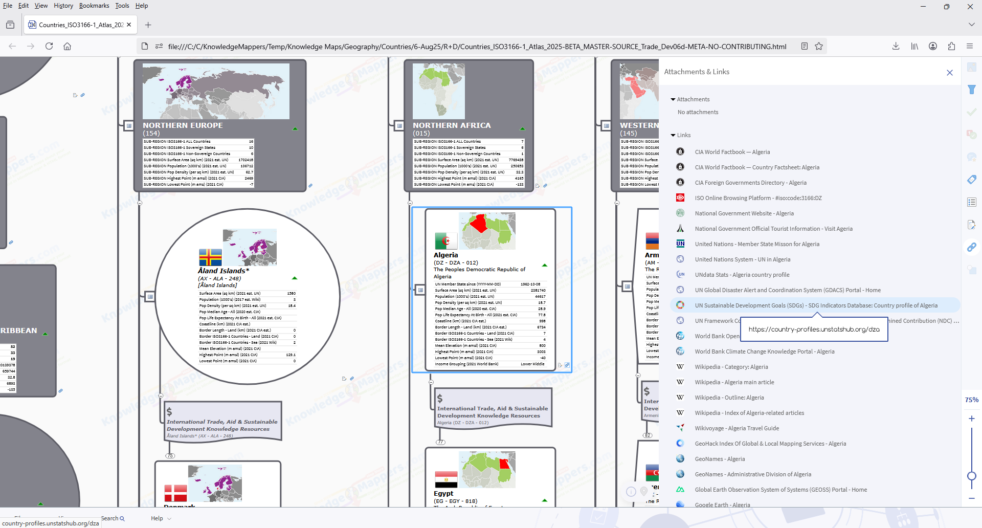
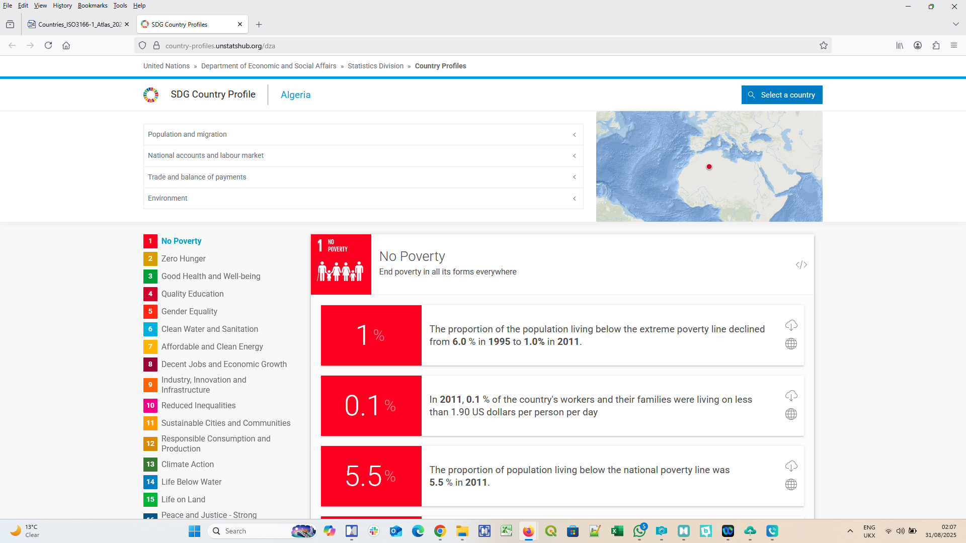
International Trade, Aid & Sustainable Development Knowledge Resource Links Collection
There are ~87 resources in this collection for each ISO3166-1 Country of the World, including….
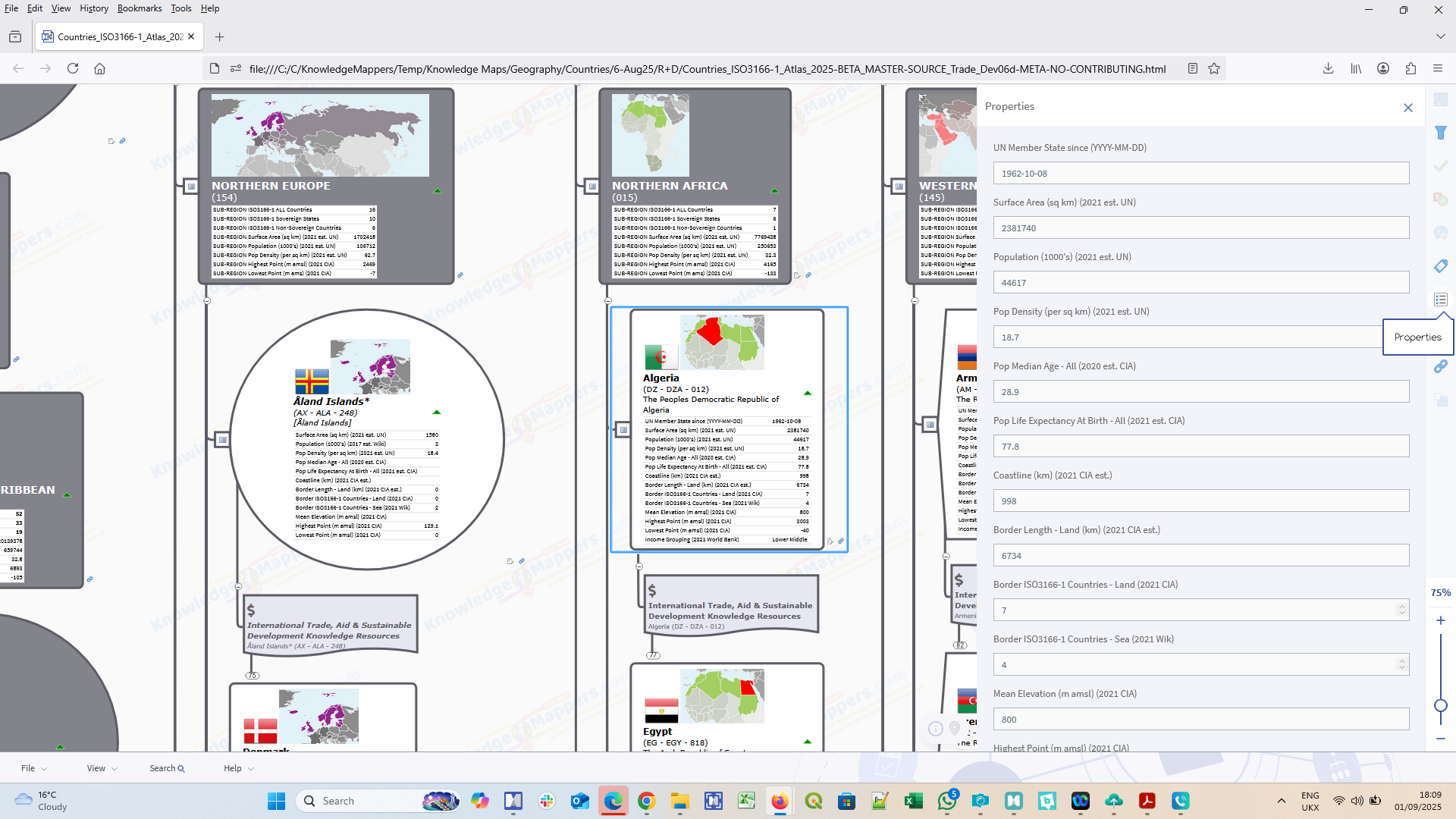
Both ‘Region’ and ‘Country’ seed branches have a rich range of contextual knowledge elements visibly embedded within them or attached to them (most of which are unique to MindManager)…
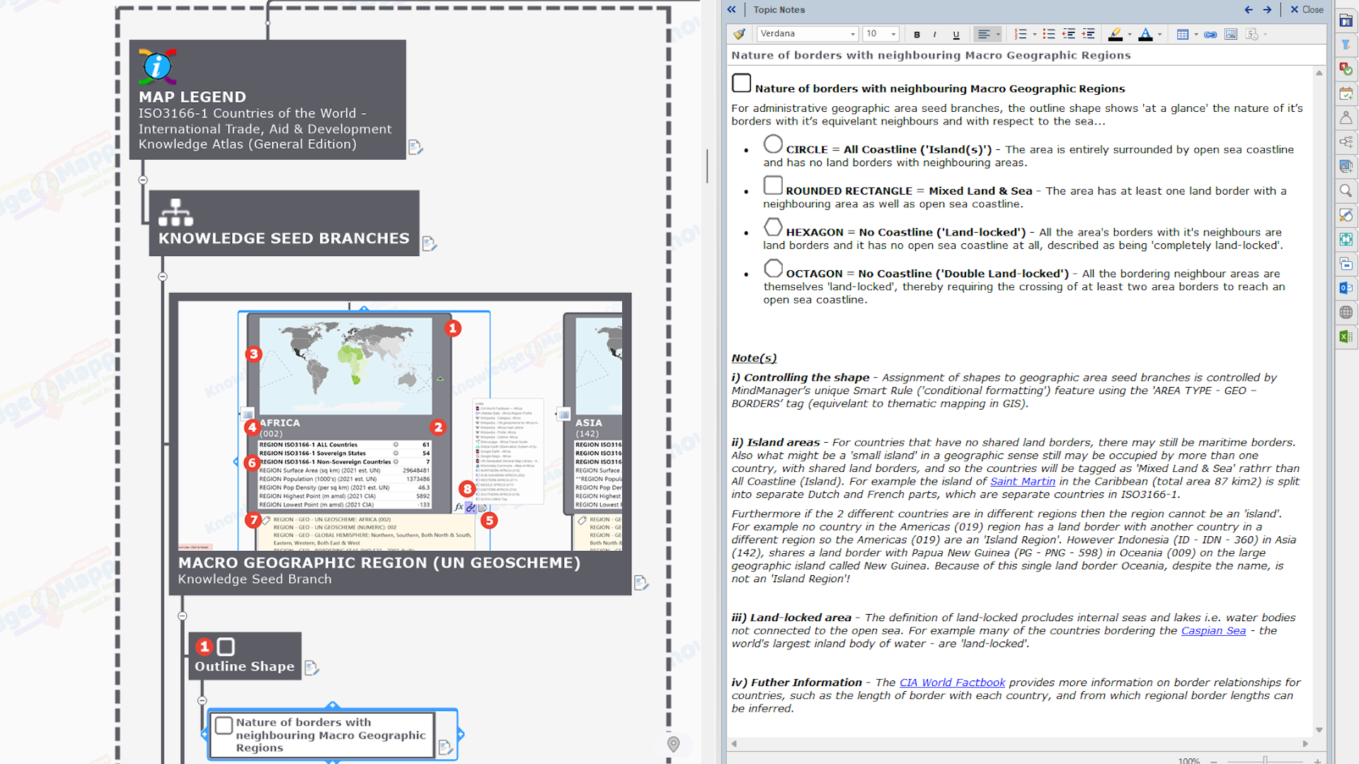
Outline shape shows the nature of the country’s borders with it’s equivalent neighbours (‘island’, ‘land-locked’ etc.).
Images of thumbnail location maps & country flags.
Title text is the country’s official ‘Short’ and ‘Full’ names and 2 and 3 letter and numeric codes (as listed on the country’s entry of the official ISO3166-1 Online Browsing Platform) in variably formatted (‘rich’) text.
Single data fields of contextual geostatistical data such as geographic area & population (taken from official United Nations Data and CIA World Factbook sources).
Index marker tags add contextual knowledge, enable ‘geo intelligent’ map filtering as well as the invokation of ‘smart rules’ to conditionally format some elements (eg. the outline shape of the branch).
Internal hyperlinks enable quick navigation ‘jumps’ between related map branches, such as between the country seed sub-branches and their parent region as well as with the ‘Quick Links’ branch.
See the MAP LEGEND branch in the map for a full description of all the different types of branches, and all the knowledge elements embedded within them or attached to them.
Show more...
This Countries of the World – International Trade, Aid and Sustainable Development Knowledge Atlas (General Edition) map then is an invaluable ‘thumb & brain friendly’ desktop (or even ‘in the field’) research tool that will enable you to spend less of your valuable time getting lost down internet search rabbit holes so you can spend more of it actually assimilating & applying the world’s best knowledgebases about the international trade and / or humanitarian aid and / or sustainable development situation in any of the countries and regions of this big old beautiful world of ours for the benefit of your own personal projects and / or those of the teams, organisations & communities of which you are part.
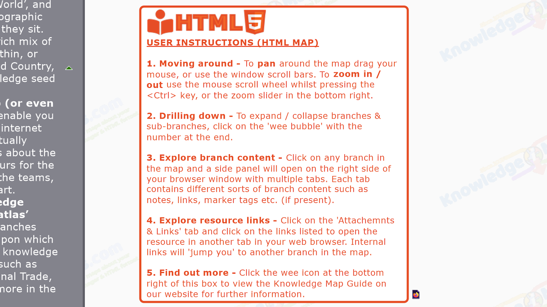
HTML Map User Tips
Alhough the HTML5 (.html) map is read only, it still has all the content – and most of the interactivity – of the original MindManager map (from which it has been exported), and it can be viewed by anybody, in any modern web browser software, on any digital device, without the need for any software plugins, as stand-alone files or embedded in web pages, on(or off)-line (once downloaded).
Reference resource – The primary purpose of this HTML map is as a visually structured, curated by a human, comprehensive index of – and ‘discover within the big picture context, minimal click’ portal to – core, public domain official / definitive / ‘plain old useful’ general & geographic knowledge resources – as well as to those in the specialized sub-branch collections – about any and all of the countries and territories that make up this big old beautiful world of ours :-).
Shareable resource – If you are viewing this HTML map via a URL generated by MindManager’s powerful Publishing platform – not only can you share that URL of the map as a whole, but if you right click a branch you will get a ‘Link to this topic’ option. If the link generated is subsequently clicked, the map will open in the browser tab focused on that branch! (how cool is that? 😉
Interactive resource – Explore the interactive features eg. perform a map filter using attached tags to hide/show particular branches and then screenshot / print the results.
. Next level – Once you are proficient with using this read-only HTML knowledge map and feel you want to take things to the next level by editing or amending it any way (or even start making your own maps!), you can start by working with the original MindManager (.mmap) map file that was also part of the product download, in conjunction with the free 30 day trial version of MindManager at any time.
Show more...
MindManager Map User Tips
For this map As well as ‘full featured viewing and interactive querying & filtering, you are free to edit, add to, adapt and/or re-purpose this map in whole or in part, and/or use it as a source of content that can be added to your own existing maps. For example…
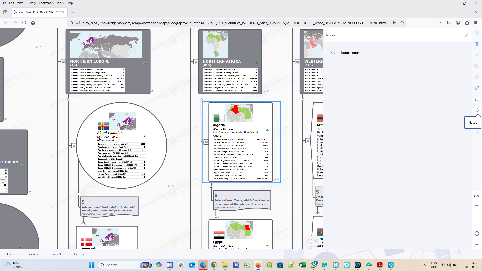
Create a living research document – Record the important information from the listed resources in the map – as a note or sub-branches – ‘in-situ’ as you discover it to create a ‘single source of truth’ for your research project that’s always up to date.
Use the content in other maps – Copy and paste a ‘GEO’ tag group to an existing map, assign to branches as appropriate, and interactively filter using your new found ‘geo-intelligence’ 😉
Create your own Territory Maps – Tag individual team members to specific Region / Country branches to create a virtual sales / operational territory map with built-in links to the world’s best public domain general and geographic knowledge resources (or physically re-arrange the region / county branches to form the territories).
. General User Tips Some tips apply when working with any of our knowledge map….
Work on a copy – We would always recommend users work on a duplicate copy of this map for each project and keep the original download file in a safe place for future working.
Strip out what you don’t need – With the original safe, you can now strip out the map content you don’t need for your project – the floating ‘meta’ and Map Legend branches, the central topic text – so the project map is as small and efficient as possible from the outset (though make sure there isn’t a more stripped back version of the map already available on the map store).
Go big – MindManager has many unique functions available – such as topic properties (single data cells), formulas and smart rules – why not incorporate some of them as you build on your new map?
See the full range of Buying Options (this map may also be available as part of one or more product bundles).
Sample Maps
To view the ‘cut down’ sample map in a new tab in your browser courtesy of MindManager’s unique Publishing feature, click the button below (it will take 30 seconds to a minute to load). If viewing on a phone you will need to scroll to the right to view the on-screen user instructions.
To download the sample map as both original MindManager (.mmap) and HTML5 (.html) files for more thorough offline investigation, complete the form below and the download links will be sent to the email address you supply.
New to our Knowledge Maps?
Watch the brief explainer videos of what’s what below before viewing / downloading a sample of this map to play with….


![MindManagers New Mojo – 17.1 Released & The Story So Far [MindManager News]](https://knowledgemappers.com/wp-content/uploads/2016/12/Blog_MindManager2017_Timeline-1024x751.png)